| Camera location | | View this and other nearby images on: OpenStreetMap |
|---|
File history
Click on a date/time to view the file as it appeared at that time.
| Date/Time | Thumbnail | Dimensions | User | Comment | |
|---|---|---|---|---|---|
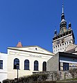
| current | 19:25, 15 April 2019 |  | 3,600 × 3,900 (5.17 MB) | Renardo la vulpo | {{Information |description={{de|1=Schäßburg (RO), Musikverein; rechts im Hintergrund der Stundturm.}} {{eo|1=Sigiŝoaro (RO), domo de la muzika asocio; dekstre fone la horloĝa turo.}} {{ro|1=Sighișoara (MS), cladirea Asociației pentru Muzicā; la dreapta în fundal turnul cu ceas.}} |date= 2019-04-01 |source= {{self-photographed}} |author= {{U|Renardo la vulpo}} |permission= {{self|cc-zero}} |other versions= }} {{Location|46|13|8.5|N|24|47|37.7|E|heading:W... |
File usage
The following page uses this file: