File:Scs Kingdom Oblasts 1922 1929 En.png
http://creativecommons.org/publicdomain/zero/1.0/deed.enCC0Creative Commons Zero, Public Domain Dedicationfalsefalse
References
- Istorijski atlas, Geokarta, Beograd, 1999.
- Denis Šehić - Demir Šehić, Istorijski atlas sveta, Beograd, 2007.
- Istorijski atlas, Intersistem kartografija, Beograd, 2010.
- Povijesni atlas, Učila - Zagreb, Zagreb, 1971.
- http://www.arhivyu.gov.rs/Data/Images/02_karta_b.jpg archive copy at the Wayback Machine
- http://papata1962.blog.bg/photos/55898/original/KraljevinaSHS1922.jpg
- http://img55.imageshack.us/img55/2465/kraljevinashs19224ap.jpg
- http://img691.imageshack.us/img691/5204/bojickarta192233oblasti.jpg
- http://www.hkv.hr/images/stories/karte/Kraljevina_SHS_podjela_1922_karta.jpg
- http://www.build.mk/docs/users/cloverstack/___EXT/MAPI/Kraljevina_Srba_Hrvata_i_Slovenaca_-_podjela_na_oblasti_1922.jpg
- http://cro-eu.com/galerija-fotografija/albums/userpics/10001/7-Kraljevina_Srba%2C_Hrvata_i_Slovenaca_-_podjela_na_oblasti_1922.jpg
- http://behar.hr/wp-content/uploads/2013/07/Image_1321.gif
Add a one-line explanation of what this file represents
Click on a date/time to view the file as it appeared at that time.
| Date/Time | Thumbnail | Dimensions | User | Comment |
|---|
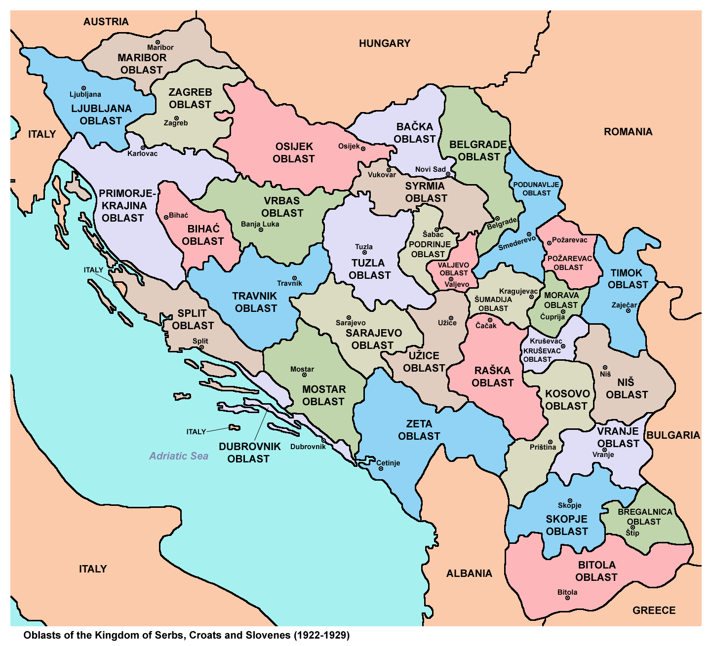
| current | 11:35, 26 August 2013 |  | 1,442 × 1,309 (208 KB) | WikiEditor2004 | {{Information |Description ={{en|1=Oblasts of the Kingdom of Serbs, Croats and Slovenes (1922-1929).}} |Source ={{own}} |Author =PANONIAN |Date =2013 |Permission = |other_versions = }} |