Click on a date/time to view the file as it appeared at that time.
| Date/Time | Thumbnail | Dimensions | User | Comment |
|---|
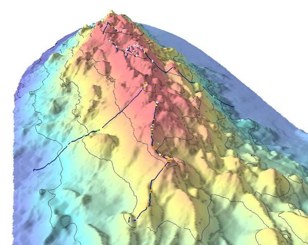
| current | 08:21, 30 October 2010 |  | 600 × 478 (59 KB) | Lamiot | {{Information |Description= {{en|Bathymetric showing details of part of Davidson Seamount. The lines indicate the path of the 2002 expedition, and the dots signifigant coral nurseries}} {{fr|Relevé bathymétrique montrant les détails du relief sous-mari |
The following other wikis use this file:
- Usage on bs.wikipedia.org
- Usage on fa.wikipedia.org
- Usage on fr.wikipedia.org
- Usage on gl.wikipedia.org
- Usage on he.wikipedia.org
- Usage on mk.wikipedia.org
- Usage on nl.wikipedia.org
- Usage on simple.wikipedia.org
- Usage on sr.wikipedia.org
- Usage on th.wikipedia.org
- Usage on tr.wikipedia.org
- Usage on tt.wikipedia.org
- Usage on www.wikidata.org
This file contains additional information, probably added from the digital camera or scanner used to create or digitize it.
If the file has been modified from its original state, some details may not fully reflect the modified file.
