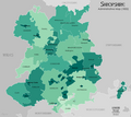
File:Shropshire1832 Map.png
Click on a date/time to view the file as it appeared at that time.
| Date/Time | Thumbnail | Dimensions | User | Comment | |
|---|---|---|---|---|---|
| current | 18:14, 2 February 2020 |  | 2,600 × 2,325 (905 KB) | XrysD | Added additional Hundred divisions and boundary corrections based on data in The Shropshire Gazetteer, Gregory (1924). |
| 12:52, 26 January 2020 |  | 2,600 × 2,325 (756 KB) | XrysD | User created page with UploadWizard |
File usage
The following 3 pages use this file: