File:ShropshireCountyMap2009.jpg
Click on a date/time to view the file as it appeared at that time.
| Date/Time | Thumbnail | Dimensions | User | Comment | |
|---|---|---|---|---|---|
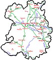
| current | 20:29, 4 May 2008 |  | 750 × 840 (376 KB) | ChrisJB | == Summary == {{Information |Description=A map of the Ceremonial county of Shropshire, England with the proposed boundaries for 2009. In 2009 the districts of non-metropolitan Shropshire will be abolished and one unitary authority will replace it. |
| 20:25, 4 May 2008 |  | 750 × 840 (376 KB) | ChrisJB | == Summary == {{Information |Description=A map of the Ceremonial county of Shropshire, England with the proposed boundaries for 2009. In 2009 the districts of non-metropolitan Shropshire will be abolished and one unitary authority will replace it. | |
| 22:50, 3 May 2008 |  | 750 × 840 (375 KB) | ChrisJB | == Summary == {{Information |Description=A map of the Ceremonial county of Shropshire, England with the proposed boundaries for 2009. In 2009 the districts of non-metropolitan Shropshire will be abolished and one unitary authority will replace it. | |
| 16:06, 3 May 2008 |  | 750 × 840 (377 KB) | ChrisJB | {{Information |Description=A map of the Ceremonial county of Shropshire, England with the proposed boundaries for 2009. In 2009 the districts of non-metropolitan Shropshire will be abolished and one unitary authority will replace it. The borough o |
File usage
The following pages on the English Wikipedia use this file (pages on other projects are not listed):