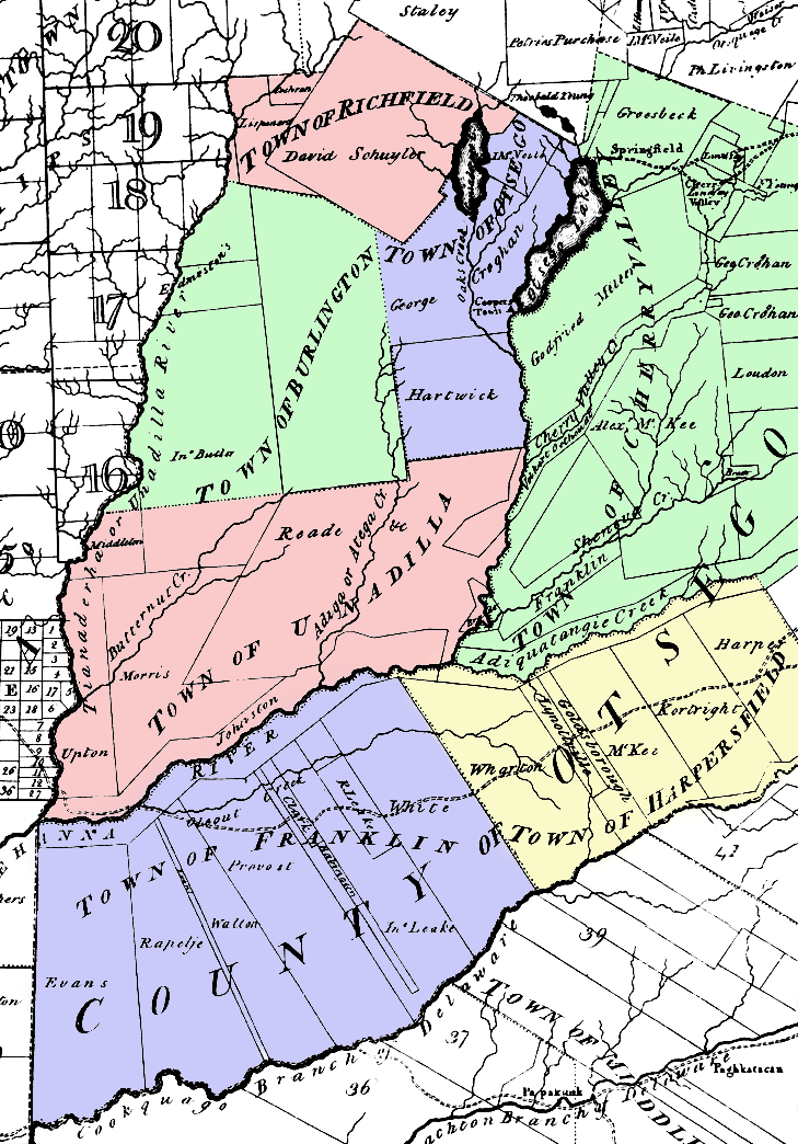
File:Simeon DeWitt Otsego County NY C.1792.png
Map of Otsego County, New York c. 1792. Note that the county was larger than it is now, but with fewer towns. This was taken from a larger map by surveyor general Simeon De Witt and colored by me.
The county's towns at the time included:
- Burlington
- Cherry Valley
- Franklin (now a part of Delaware County, New York)
- Harpersfield (now a part of Delaware County, New York)
- Otsego
- Richfield
- Unadilla
Licensing
|
This work is in the public domain in its country of origin and other countries and areas where the copyright term is the author's life plus 70 years or fewer. | |
| This file has been identified as being free of known restrictions under copyright law, including all related and neighboring rights. | |