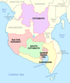
File:Socsksargen.png
Click on a date/time to view the file as it appeared at that time.
| Date/Time | Thumbnail | Dimensions | User | Comment | |
|---|---|---|---|---|---|
| current | 19:15, 28 November 2021 |  | 1,846 × 2,183 (475 KB) | Magog the Ogre | Reverted to version as of 03:41, 28 November 2021 (UTC) |
| 03:41, 28 November 2021 | No thumbnail | 865 × 1,197 (151 KB) | Sanchezph | Reverted to version as of 03:37, 28 November 2021 (UTC) | |
| 03:41, 28 November 2021 |  | 1,846 × 2,183 (475 KB) | Sanchezph | Reverted to version as of 08:56, 30 March 2021 (UTC) | |
| 03:37, 28 November 2021 | No thumbnail | 865 × 1,197 (151 KB) | Sanchezph | Reverted to version as of 12:17, 28 March 2021 (UTC) | |
| 08:56, 30 March 2021 |  | 1,846 × 2,183 (475 KB) | HueMan1 | Reverted to version as of 15:32, 14 May 2020 (UTC) | |
| 12:17, 28 March 2021 | No thumbnail | 865 × 1,197 (151 KB) | Teamayuiyui | 4 Provinces | |
| 15:32, 14 May 2020 |  | 1,846 × 2,183 (475 KB) | HueMan1 | Reverted to version as of 01:23, 30 January 2019 (UTC) | |
| 01:23, 30 January 2019 |  | 1,846 × 2,183 (475 KB) | Exec8 | Border adjustments | |
| 05:20, 29 January 2019 |  | 1,829 × 2,180 (382 KB) | Exec8 | == {{int:filedesc}} == {{Information |description=Political Map of Socsksargen Region, Philippines. Showing Cotabato, Sarangani, South Cotabato, Sultan Kudarat and General Santos City. Used:PhlMapCit.svg by Felipe_Aira and Philippines location map.svg by [[User:No... |
File usage
The following pages on the English Wikipedia use this file (pages on other projects are not listed):
Global file usage
The following other wikis use this file:
- Usage on bcl.wikipedia.org
- Usage on ceb.wikipedia.org
- Usage on es.wikipedia.org
- Usage on hi.wikipedia.org
- Usage on incubator.wikimedia.org
- Usage on ka.wikipedia.org
- გენერალ-სანტოსი
- კოტაბატოს პროვინცია
- სამხრეთი კოტაბატო
- თარგი:საკოკსკსარგენი
- ბანგა (სამხრეთი კოტაბატო)
- ლაკე-სებუ (სამხრეთი კოტაბატო)
- ნორალა
- პოლომოლოკი
- სანტო-ნინიო (სამხრეთი კოტაბატო)
- სურალია
- ტამპაკანი
- ტუპი (სამხრეთი კოტაბატო)
- ტანტანგანი
- ტ'ბოლი (სამხრეთი კოტაბატო)
- ალამადა
- ალეოსანი
- ანტიპასი (კოტაბატო)
- არაკანი (კოტაბატო)
- ბანისილანი
- კარმენი (კოტაბატო)
- კაბაკანი
- ლიბუნგანი
- მაგპეტი
- მაკილალა
- მატალამი
- პიგკავაიანი
- მ'ლანგი
- მიდსაიაპი
- პიკიტი
- პრესიდენტ-როხასი (კოტაბატო)
- ტულუნანი
- ალაბელი
- გლანი (სარანგანი)
- კიამბა (სარანგანი)
- მაასიმი
- ბაგუმბაიანი (სულთან-კუდარათი)
- მაიტუმი
- მალაპატანი
- მალუნგონი
- კოლუმბიო
- ესპერანსა (სულთან-კუდარათი)
View more global usage of this file.