File:Somaliland.png
Click on a date/time to view the file as it appeared at that time.
| Date/Time | Thumbnail | Dimensions | User | Comment | |
|---|---|---|---|---|---|
| current | 17:57, 20 June 2020 | 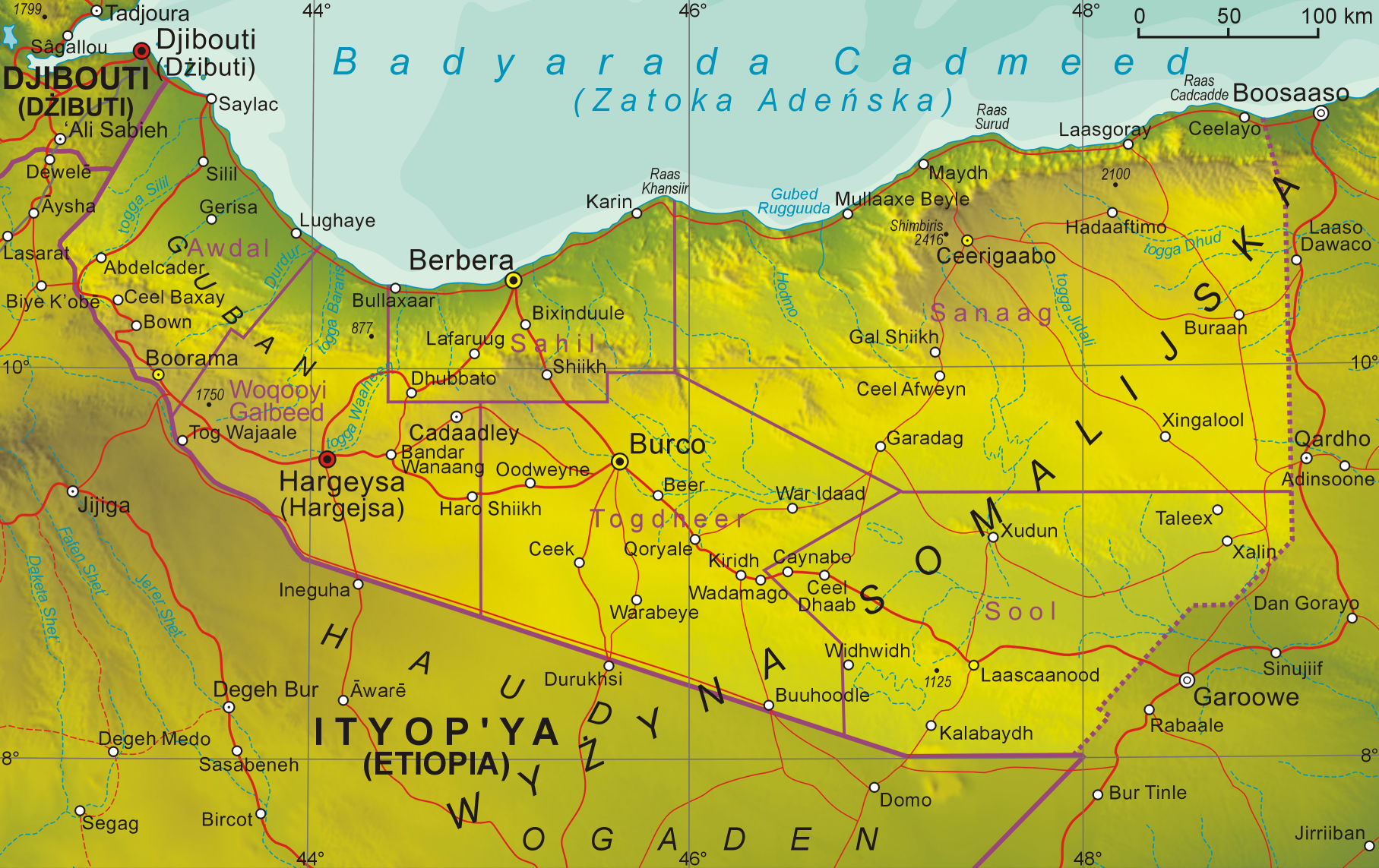 | 1,815 × 1,143 (2.6 MB) | Kzl55 | Reverted to version as of 08:20, 1 November 2008 (UTC) Irrelevant, map is about claimed territory. |
| 18:35, 16 June 2020 |  | 800 × 504 (724 KB) | Meelpringthusss | added disputed region | |
| 08:20, 1 November 2008 |  | 1,815 × 1,143 (2.6 MB) | Aotearoa | {{Information |Description= |Source= |Date= |Author= |Permission= |other_versions= }} | |
| 08:55, 12 October 2008 |  | 1,360 × 854 (1.65 MB) | Aotearoa | {{Information |Description={{en|1=Map of Somaliland}} {{pl|1=Mapa Somalilandu}} |Source=Praca własna osoby przesyłającej (own work by uploader) |Author=Aotearoa |Date=12.10.2008 |Permission= |other_versions= }} <!--{{ImageUpload|full |
File usage
The following 2 pages use this file:
Global file usage
The following other wikis use this file:
- Usage on en.wikibooks.org
- Usage on os.wikipedia.org
- Usage on pl.wikipedia.org