Loading
  • 21 Aug, 2019

  • By, Wikipedia

File:South Carolina Population Map.png


Original upload log

The original description page was here. All following user names refer to en.wikipedia.
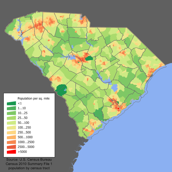
  • 2006-02-21 18:35 JimIrwin 700×525× (45112 bytes) South Carolina population density map based on Census 2000. See the [[User:JimIrwin/Lineage_of_population_maps|data lineage]] for a process description.

Captions

Add a one-line explanation of what this file represents

Items portrayed in this file

depicts

21 February 2006

File history

Click on a date/time to view the file as it appeared at that time.

Date/TimeThumbnailDimensionsUserComment
current14:33, 11 December 2011Thumbnail for version as of 14:33, 11 December 2011600 × 600 (198 KB)JimIrwin2010 census update
02:30, 9 August 2010Thumbnail for version as of 02:30, 9 August 2010700 × 525 (44 KB)File Upload Bot (Magnus Manske) {{BotMoveToCommons|en.wikipedia|year={{subst:CURRENTYEAR}}|month={{subst:CURRENTMONTHNAME}}|day={{subst:CURRENTDAY}}}} {{Information |Description={{en| South Carolina population density map based on Census 2000. See the [[:en:User:JimIrwin/Lineage_of_po
The following pages on the English Wikipedia use this file (pages on other projects are not listed):

Global file usage

The following other wikis use this file: