File:South India Map 1794.jpg
This work is in the
public domain in its country of origin and other countries and areas where the
copyright term is the author's
life plus 100 years or fewer.
 You must also include a United States public domain tag to indicate why this work is in the public domain in the United States.
| This file has been identified as being free of known restrictions under copyright law, including all related and neighboring rights.
|
https://creativecommons.org/publicdomain/mark/1.0/PDMCreative Commons Public Domain Mark 1.0falsefalse
Click on a date/time to view the file as it appeared at that time.
| Date/Time | Thumbnail | Dimensions | User | Comment |
|---|
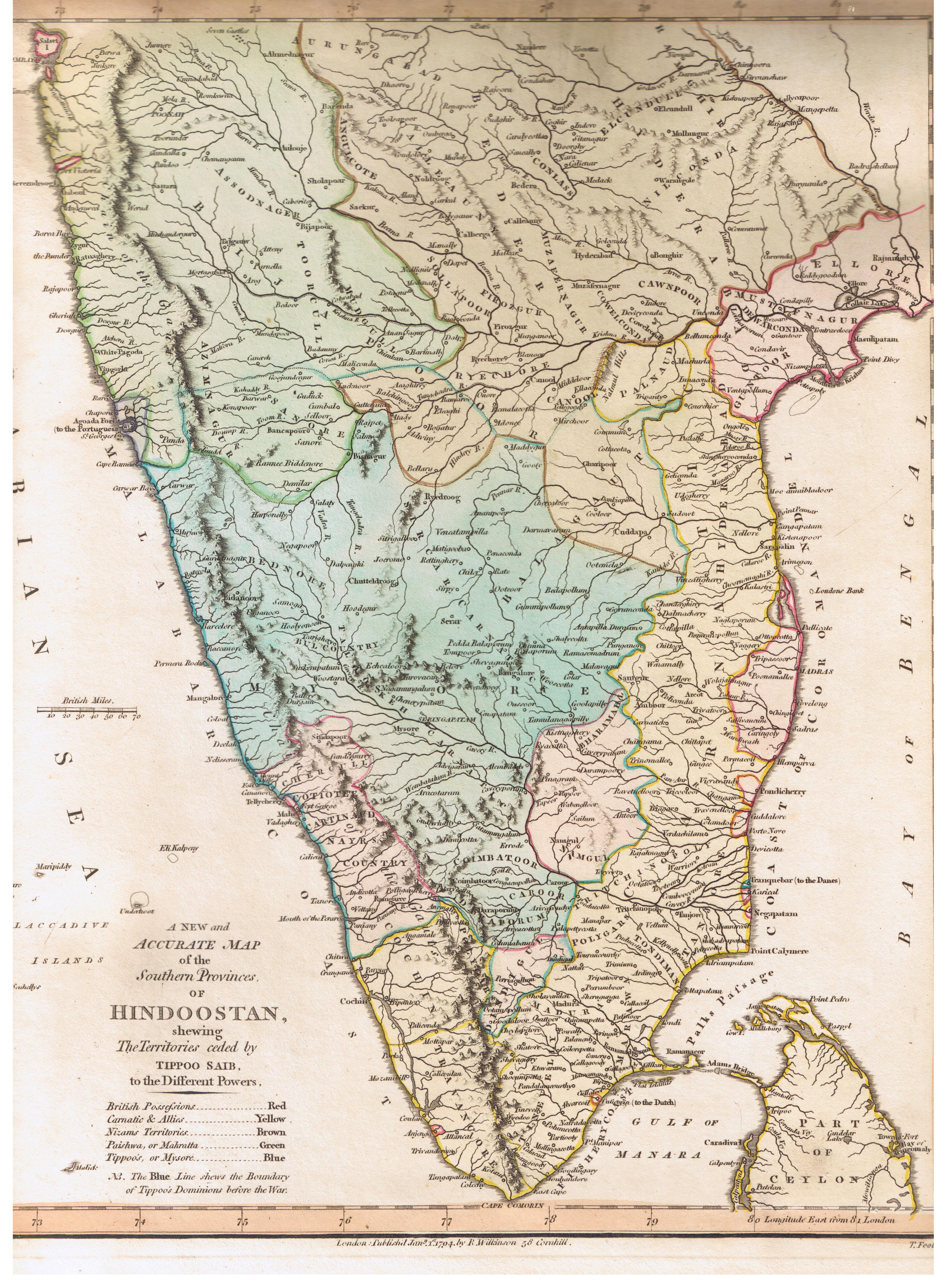
| current | 16:57, 10 August 2007 | 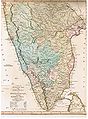 | 3,400 × 4,608 (2.59 MB) | Marcus334 | {{Information |Description= A New and Accurate Map of the Southern Provinces of Hindoostan, shewing The Territories ceded by TIPOO SAHIB to the Different Powers |Source= Published by R. Wilkinson, 58 Cornhill, London |Date= Jan 1, 1794 |Author= T. Foot Sc |
The following 2 pages use this file:
The following other wikis use this file:
- Usage on ar.wikipedia.org
- Usage on ca.wikipedia.org
- Usage on ta.wikipedia.org
- Usage on vi.wikipedia.org
This file contains additional information, probably added from the digital camera or scanner used to create or digitize it.
If the file has been modified from its original state, some details may not fully reflect the modified file.