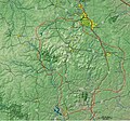
File:St Francois Mtns Relief Detail V1.jpg
Click on a date/time to view the file as it appeared at that time.
| Date/Time | Thumbnail | Dimensions | User | Comment | |
|---|---|---|---|---|---|
| current | 20:01, 11 September 2013 |  | 1,016 × 947 (406 KB) | Kbh3rd | Fill outline of Council Bluff Lake at headwaters of Big River. |
| 03:17, 22 February 2009 |  | 1,016 × 947 (395 KB) | Kbh3rd | ||
| 04:39, 17 February 2009 |  | 1,016 × 947 (394 KB) | Kbh3rd | {{Information |Description={{en|1=Detailed shaded relief map of the St. Francois Mountains. The red dashed line delineates the St. Francois Mountain physiographic province.}} |Source=Own work by uploader |Author=[[User:Kbh3 |
File usage
The following 2 pages use this file:
Global file usage
The following other wikis use this file:
- Usage on ru.wikipedia.org