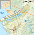
File:Steenbras Dam Catchment Map.svg
Click on a date/time to view the file as it appeared at that time.
| Date/Time | Thumbnail | Dimensions | User | Comment | |
|---|---|---|---|---|---|
| current | 11:07, 13 August 2021 |  | 678 × 688 (1.58 MB) | Htonl | add locator map and scale bar |
| 20:47, 12 August 2021 |  | 678 × 688 (1.13 MB) | Htonl | covert text to paths again | |
| 20:47, 12 August 2021 |  | 678 × 688 (1.02 MB) | Htonl | get rid of grey border | |
| 19:50, 12 August 2021 |  | 678 × 688 (1.13 MB) | Htonl | tiny label tweak | |
| 18:55, 12 August 2021 |  | 678 × 688 (1.13 MB) | Htonl | Convert text to paths for better rendering | |
| 18:54, 12 August 2021 |  | 678 × 688 (1.02 MB) | Htonl | Uploaded own work with UploadWizard |
File usage
The following 3 pages use this file:
Global file usage
The following other wikis use this file:
- Usage on ha.wikipedia.org
- Usage on ig.wikipedia.org
- Usage on yo.wikipedia.org