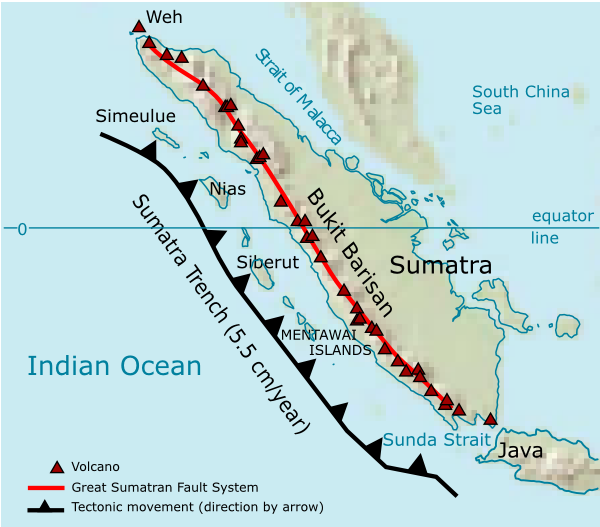
File:Sumatra Volcanoes.png
Source of maps:
- Base map is a truncated public domain image: Image:Southeast asia.svg.
- Geological trench system is taken from Simoes, M., et al. (2004), The Sumatra subduction zone: A case for a locked fault zone extending into the mantle, J. of Geophysical Research, 109. DOI: 10.1029/2003JB002958.
- Volcanoes location was traced from en:Google Earth system.