Loading
  • 21 Aug, 2019

  • By, Wikipedia

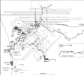
File:Swan River Colony Land Grants Map.png

This is a map of the land grants around the Swan River, Western Australia in 1839. The map was drawn by John Arrowsmith from the survey data of John Septimus Roe. This version is a slight adaption of the original that appeared in Nathaniel Ogle's 1839 publication The Colony of Western Australia.

The image was scanned from a reproduction in

Appleyard, R. T. and Toby Manford (1979). The Beginning: European Discovery and Early Settlement of Swan River Western Australia, Nedlands, Western Australia: University of Western Australia Press. ISBN 0855641460.

Due to its age, the image is in the public domain under both Australian and U.S. Copyright Law.

Licensing

Public domain

This work is in the public domain in its country of origin and other countries and areas where the copyright term is the author's life plus 70 years or fewer.


You must also include a United States public domain tag to indicate why this work is in the public domain in the United States.
This file has been identified as being free of known restrictions under copyright law, including all related and neighboring rights.

Captions

Add a one-line explanation of what this file represents

Items portrayed in this file

depicts

image/png

File history

Click on a date/time to view the file as it appeared at that time.

Date/TimeThumbnailDimensionsUserComment
current10:26, 16 June 2021Thumbnail for version as of 10:26, 16 June 20214,112 × 3,651 (241 KB)ITBFlooks like this version is higher quality, unless I'm mistaken?
00:11, 17 April 2008Thumbnail for version as of 00:11, 17 April 20081,028 × 913 (252 KB)HesperianSmaller version; previous version was too big to thumb.
00:11, 13 February 2006Thumbnail for version as of 00:11, 13 February 20064,112 × 3,651 (241 KB)Hesperianprevious version was upside down.
00:10, 13 February 2006Thumbnail for version as of 00:10, 13 February 20064,112 × 3,651 (240 KB)Hesperian== Summary == This is a map of the land grants around the Swan River, Western Australia in 1839. The map was drawn by John Arrowsmith from the survey data of John Septimus Roe. This version is a slight adaption of the original that appeared in Nathan

Global file usage

The following other wikis use this file:

Metadata