Click on a date/time to view the file as it appeared at that time.
| Date/Time | Thumbnail | Dimensions | User | Comment |
|---|
| current | 20:24, 21 October 2006 | 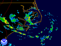 | 597 × 455 (36 KB) | Hello32020 | {{Information |Description=This is a radar image of Tropical Storm Arthur, 1996, from NWS Morehead City, NC NEXRAD radar and was made using [http://www.ncdc.noaa.gov/oa/radar/jnx/ JAVA NEXRAD tool]. |Source=Radar data from data from the [http://www.ncdc.n |
The following pages on the English Wikipedia use this file (pages on other projects are not listed):
The following other wikis use this file:
- Usage on es.wikipedia.org
- Usage on pt.wikipedia.org
- Usage on zh.wikipedia.org
