File:TS Emilia 2006.jpg
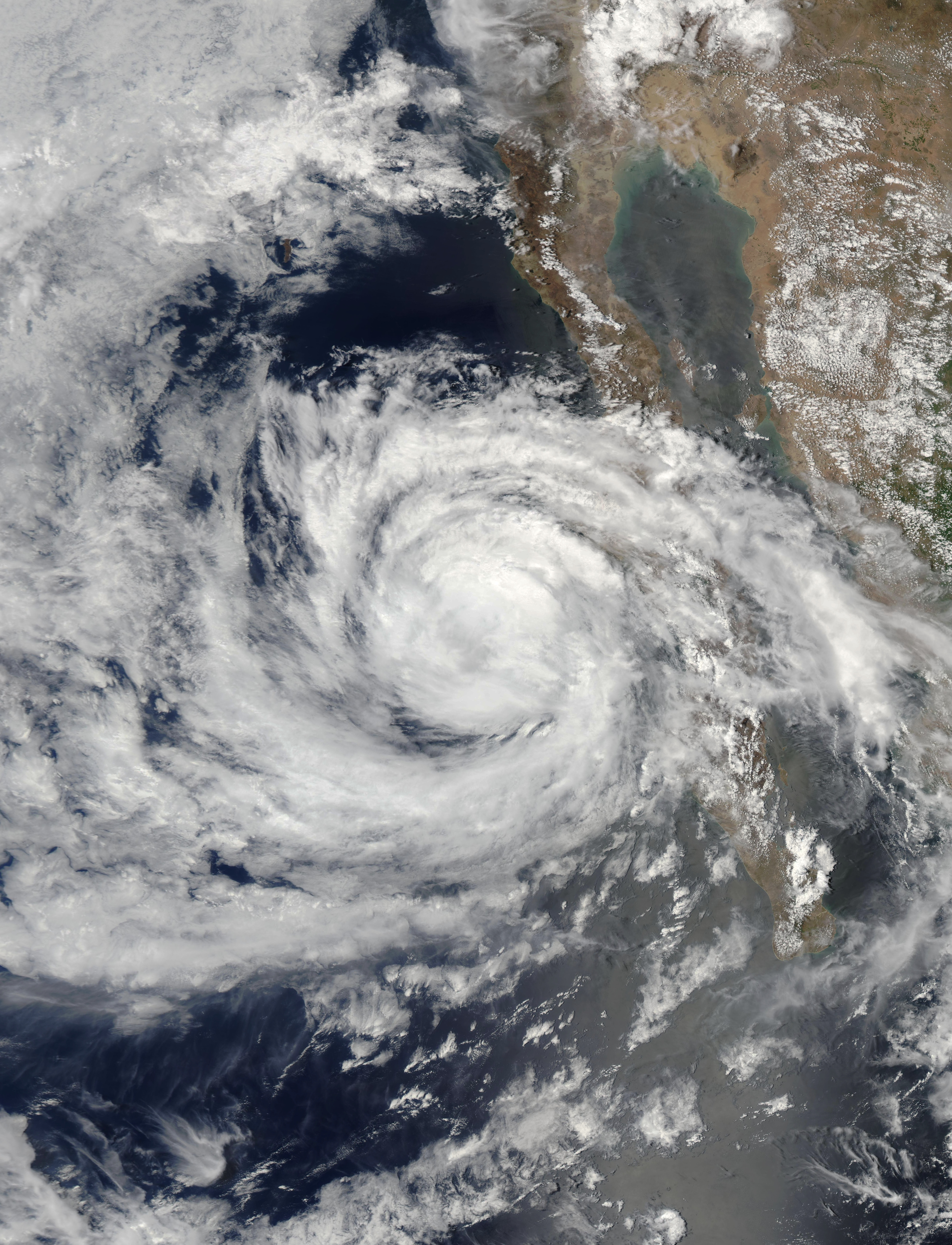
Tropical Storm Emilia skirted the coast of Baja California as it moved northwest into the Pacific Ocean on July 26, 2006. When the Moderate Resolution Imaging Spectroradiometer (MODIS) on NASA’s Aqua satellite captured this image at 1:35 p.m. Pacific Daylight Time (20:25 UTC), the storm had sustained winds of 100 kilometers per hour (65 miles per hour) with stronger gusts. Though these winds were still about ten miles per hour under hurricane status, Emilia has the distinct spiraling clouds and round shape that mark a hurricane. In the hours after this image was taken, Emilia moved out over the Pacific Ocean and degraded into a tropical depression, said the National Hurricane Center.
The large image provided above is at MODIS’ maximum resolution of 250 meters per pixel. The image is available in additional resolutions from the MODIS Rapid Response Team.
Date
Source
http://earthobservatory.nasa.gov/NaturalHazards/natural_hazards_v2.php3?img_id=13733
Author
NASA image courtesy Jeff Schmaltz, MODIS Land Rapid Response Team at NASA GSFC
Permission
(Reusing this file)
(Reusing this file)
| This file is in the public domain in the United States because it was solely created by NASA. NASA copyright policy states that "NASA material is not protected by copyright unless noted". (See Template:PD-USGov, NASA copyright policy page or JPL Image Use Policy.) | ||
 |
Warnings:
|


