Loading
  • 21 Aug, 2019

  • By, Wikipedia

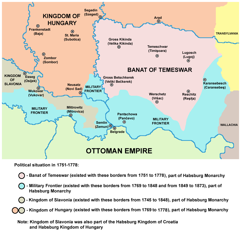
File:Tamis Banat1751 1778.png

self made map by user:PANONIAN

Public domain I, the copyright holder of this work, release this work into the public domain. This applies worldwide.
In some countries this may not be legally possible; if so:
I grant anyone the right to use this work for any purpose, without any conditions, unless such conditions are required by law.

Captions

Add a one-line explanation of what this file represents

Items portrayed in this file

depicts

1 August 2009

image/png

File history

Click on a date/time to view the file as it appeared at that time.

Date/TimeThumbnailDimensionsUserComment
current11:55, 24 June 2014Thumbnail for version as of 11:55, 24 June 2014996 × 962 (112 KB)PANONIANaesthetics
13:18, 14 February 2013Thumbnail for version as of 13:18, 14 February 2013996 × 962 (114 KB)PANONIAN{{Information |Description ={{en|1=easthetics}} |Source =easthetics |Author =easthetics |Date = |Permission = |other_versions = }}
19:51, 30 September 2011Thumbnail for version as of 19:51, 30 September 2011998 × 962 (114 KB)PANONIANcorrection
14:49, 30 September 2011Thumbnail for version as of 14:49, 30 September 2011998 × 962 (115 KB)PANONIANsome corrections
11:27, 1 August 2009Thumbnail for version as of 11:27, 1 August 2009998 × 962 (115 KB)PANONIAN==Description== * '''English''': map of the Banat of Temeswar, Kingdom of Slavonia and Military Frontier in 1751-1778. * '''Serbian''': мапа Тамишког Баната, Краљевине Славоније и војне границе (1751-1778.
The following pages on the English Wikipedia use this file (pages on other projects are not listed):

Global file usage

The following other wikis use this file: