File:Tashkent History 2000.jpg
Click on a date/time to view the file as it appeared at that time.
| Date/Time | Thumbnail | Dimensions | User | Comment | |
|---|---|---|---|---|---|
| current | 17:54, 7 November 2008 | 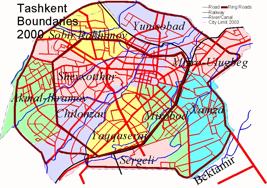 | 929 × 655 (462 KB) | Cosnahang~commonswiki | {{Information |Description= |Source= |Date= |Author= |Permission= |other_versions= }} |
| 16:31, 7 November 2008 |  | 929 × 655 (462 KB) | Cosnahang~commonswiki | |Description=Map Of Tashkent in 2000 showing the boundaries of the city, main roads, railways and waterways (7 of 7) |Source=Self generated by author based on the Geographical Atlas of Tashkent (Ташкент Географический Атл |
File usage
The following pages on the English Wikipedia use this file (pages on other projects are not listed):
Global file usage
The following other wikis use this file:
- Usage on ar.wikipedia.org
- Usage on ast.wikipedia.org
- Usage on azb.wikipedia.org
- Usage on bn.wikipedia.org
- Usage on ca.wikipedia.org
- Usage on de.wikipedia.org
- Usage on eo.wikipedia.org
- Usage on es.wikipedia.org
- Usage on eu.wikipedia.org
- Usage on fi.wikipedia.org
- Usage on hyw.wikipedia.org
- Usage on ko.wikipedia.org
- Usage on mn.wikipedia.org
- Usage on pnb.wikipedia.org
- Usage on pt.wikipedia.org
- Usage on ru.wikipedia.org
- Usage on sk.wikipedia.org
- Usage on tl.wikipedia.org
- Usage on uz.wikipedia.org
- Usage on vi.wikipedia.org