File:Teluk Kayeli.jpg
| This is a retouched picture, which means that it has been digitally altered from its original version. Modifications: crop. The original can be viewed here: Buru tpc 1967.jpg:
|
This work is in the public domain in the United States because it is a work prepared by an officer or employee of the United States Government as part of that person’s official duties under the terms of Title 17, Chapter 1, Section 105 of the US Code.
Note: This only applies to original works of the Federal Government and not to the work of any individual U.S. state, territory, commonwealth, county, municipality, or any other subdivision. This template also does not apply to postage stamp designs published by the United States Postal Service since 1978. (See § 313.6(C)(1) of Compendium of U.S. Copyright Office Practices). It also does not apply to certain US coins; see The US Mint Terms of Use.
|
 | |
| This file has been identified as being free of known restrictions under copyright law, including all related and neighboring rights. | ||
Original upload log
This image is a derivative work of the following images:
- File:Buru_tpc_1967.jpg licensed with PD-USGov
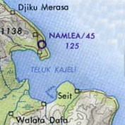
- 2006-06-07T11:23:23Z File Upload Bot (Magnus Manske) 1057x797 (152064 Bytes) {{Information| |Description= Buru Island (Operational Navigation Chart) original scale 1:1,000,000. Portion of Defense Mapping Agency ONC M-12 1967 (152K) Not for navigational use {{PD-PCL|http://www.lib.utexas.edu/maps/mi
Uploaded with derivativeFX