File:Territorial Changes Of Caloocan.png
English ∙ español ∙ 日本語 ∙ Tagalog ∙ 简体中文 ∙ 繁體中文 ∙ +/−

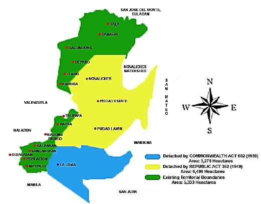
| Territorial changes of Caloocan. Green: existing territorial boundaries. Blue: Detached by Commonwealth Act 502 (1939). Yellow: Detached by Republic Act 392 (1949).
File history
Click on a date/time to view the file as it appeared at that time.
| Date/Time | Thumbnail | Dimensions | User | Comment |
|---|
| current | 19:05, 26 April 2020 |  | 521 × 407 (87 KB) | Seventide | Cross-wiki upload from en.wikipedia.org |
File usage
The following pages on the English Wikipedia use this file (pages on other projects are not listed):
This file contains additional information, probably added from the digital camera or scanner used to create or digitize it.
If the file has been modified from its original state, some details may not fully reflect the modified file.
