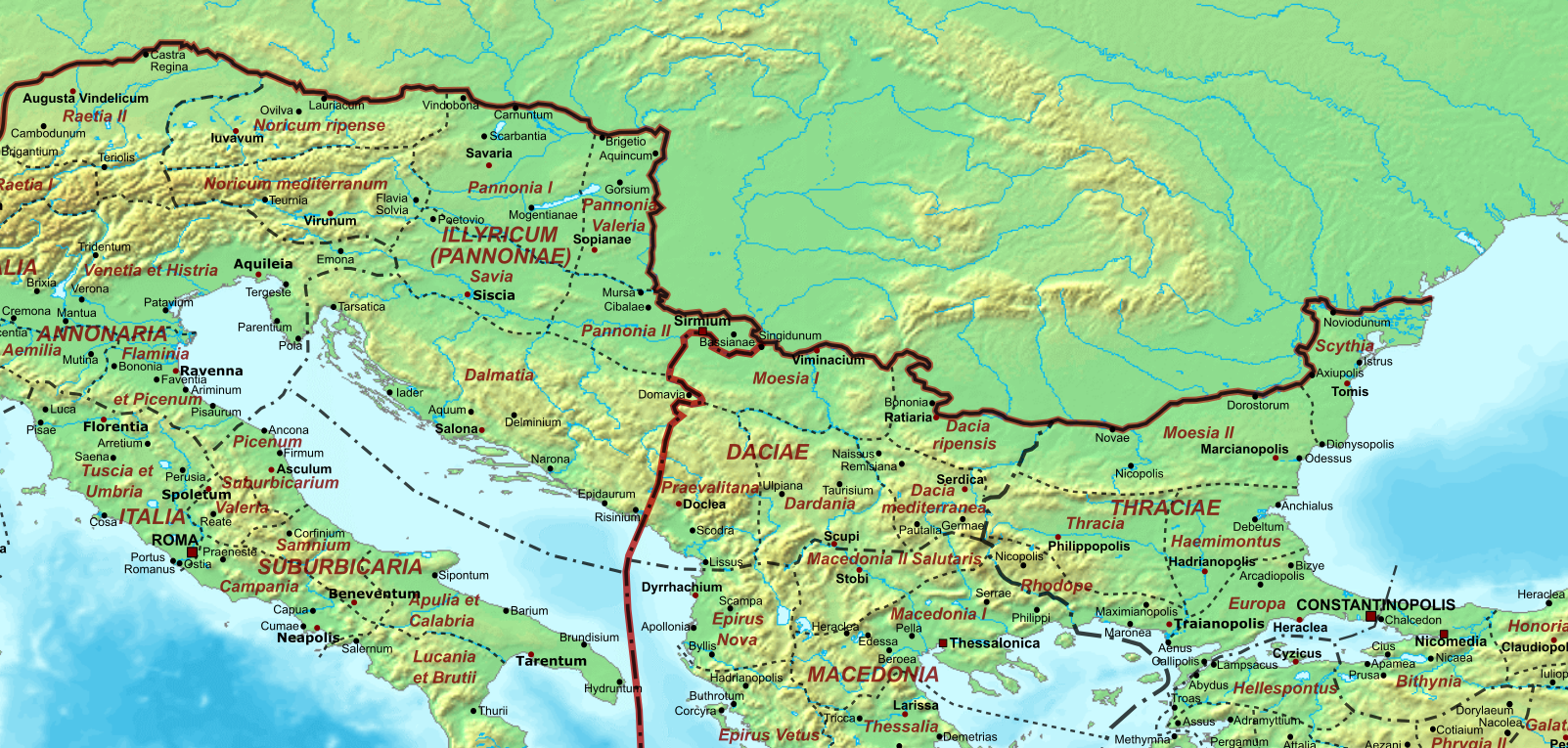
File:The Roman Empire Ca 400 AD (Danube Provinces).png
Base map found at User:Koba-chan/Topographic map, otherwise self-made. Data based on maps in atlases (Westermann's Atlas zur Weltgeschichte, the Academy of Athens' History of the Greek Nation, etc.) and the internet and on contemporary sources, primarily the Notitia Dignitatum and the Synecdemus.
 Note: the exact course of the provincial boundaries is often uncertain, and in the case of Britain, entirely unknown. Therefore, provincial boundaries are in many cases only approximate, based on the best available information. Any help and corrections are welcome.
Author
Cplakidas
Other versions

-
 SVG version

Licensing
| I, the copyright holder of this work, release this work into the public domain. This applies worldwide. In some countries this may not be legally possible; if so: I grant anyone the right to use this work for any purpose, without any conditions, unless such conditions are required by law. |
| Annotations | This image is annotated: View the annotations at Commons |
.png)
.png)