File:ThompsonRiverBritishColumbia Location.png
Thompson River, British Columbia - Map
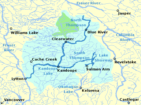
This map shows the location of the Thompson River, including drainage and major lakes.
Created by en:User:al guy on August 13, 2004 and released under the GFDL. Colours are based on the discussions at en:Wikipedia talk:WikiProject Maps. Map drawn in GIMP. Underlying data © 2003. Government of Canada with permission from Natural Resources Canada and used under license archive copy at the Wayback Machine

|
Permission is granted to copy, distribute and/or modify this document under the terms of the GNU Free Documentation License, Version 1.2 or any later version published by the Free Software Foundation; with no Invariant Sections, no Front-Cover Texts, and no Back-Cover Texts. A copy of the license is included in the section entitled GNU Free Documentation License. |
| This file is licensed under the Creative Commons Attribution-Share Alike 3.0 Unported license. | ||
| ||
| This licensing tag was added to this file as part of the GFDL licensing update. |