Click on a date/time to view the file as it appeared at that time.
| Date/Time | Thumbnail | Dimensions | User | Comment |
|---|
| current | 04:13, 4 November 2021 | 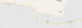 | 1,523 × 522 (95 KB) | Tbhotch | {{Information |Description=Mapa de las curvas 11 y 12 de la Línea 12 del Metro de la Ciudad de México |Source=Mapa obtenido de [https://wikimapia.org/#lang=es&lat=19.298750&lon=-99.040858&z=17&m=w Wikimapia] |Date=4 de noviembre de 2021 |Author=Wikimapia.org (mapa); Tbhotch (modificaciones) |Permission=Wikimapia is an open website. Their license is: {{Cc-by-sa-3.0}} |other_versions={{Retouched picture|Se indica con número las curvas 11 y 12|editor=Tbhotch}} }} Category:Nopalera (station)... |
The following pages on the English Wikipedia use this file (pages on other projects are not listed):
This file contains additional information, probably added from the digital camera or scanner used to create or digitize it.
If the file has been modified from its original state, some details may not fully reflect the modified file.
