File:Tropical Storm Edouard 2002.jpg
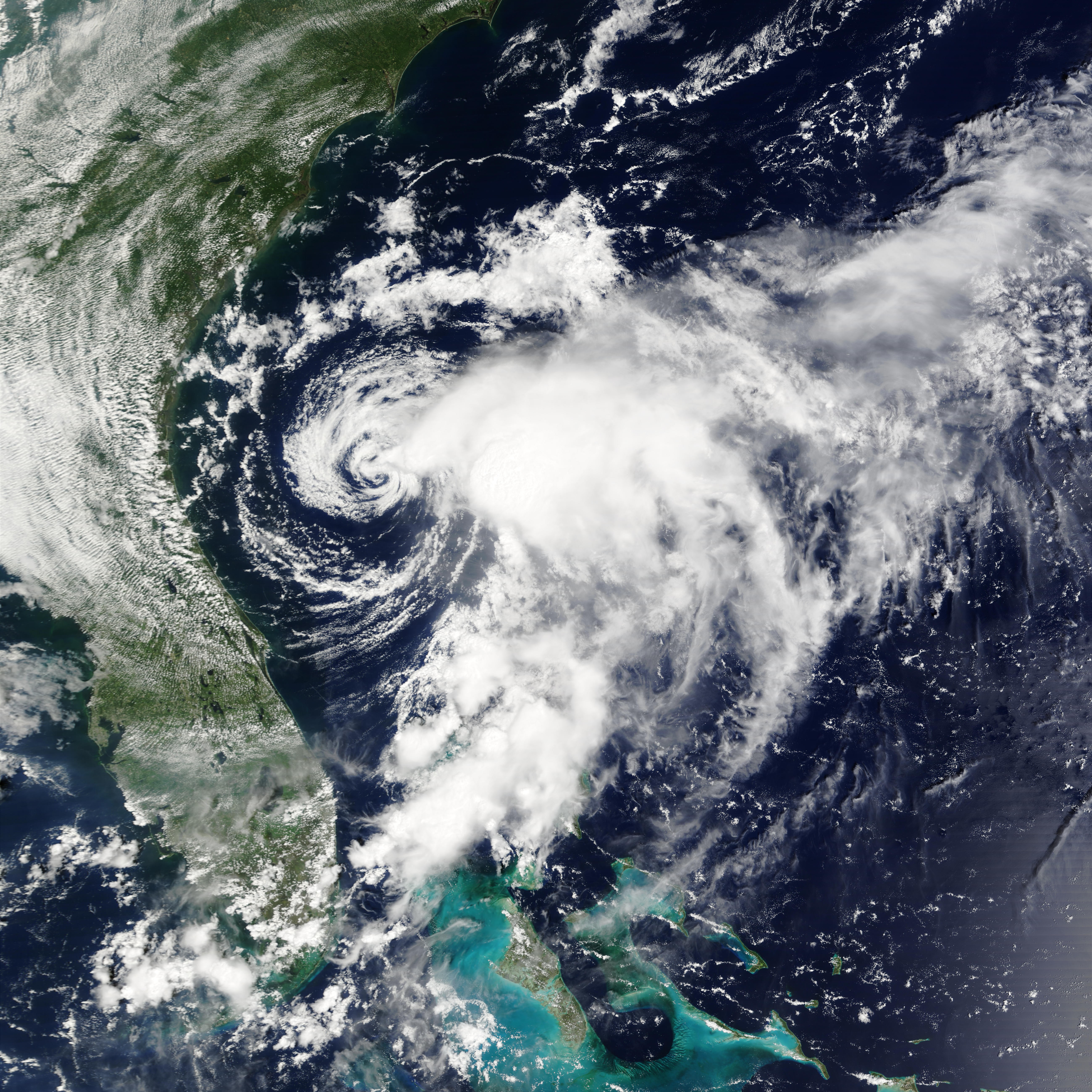
Tropical Storm Edouard is looking decidedly more organized in this true-color Moderate Resolution Imaging Spectroradiometer (MODIS) image from Tuesday, September 3, 2002, than it did the previous day. Located off the Atlantic Coast of the southeast United States, the storm briefly intensified between September 2 and 3, but by the time this image was acquired by the Terra satellite on Tuesday afternoon, the intensification had halted.
Edouard is expected to weaken to tropical depression status as it moves quickly toward land. As of Tuesday evening, forecasters were predicting the storm would come ashore in northern Florida within 24 hours.
Date
Source
http://earthobservatory.nasa.gov/NaturalHazards/natural_hazards_v2.php3?img_id=4735
Author
Image courtesy Jacques Descloitres, MODIS Land Rapid Response Team at NASA GSFC
Permission
(Reusing this file)
Other versions
Image:TS Edouard 03 sept 2002 1535Z.jpg
(Reusing this file)
| This file is in the public domain in the United States because it was solely created by NASA. NASA copyright policy states that "NASA material is not protected by copyright unless noted". (See Template:PD-USGov, NASA copyright policy page or JPL Image Use Policy.) | ||
 |
Warnings:
|


