File:USGS Intensity Map January 1 2024 Anamizu Earthquake M 7.5.pdf
ShakeMap: 42 km NE of Anamizu, Ishikawa, JP
Jan 01, 2024 07:10:09 UTC M7.5 N37.50 E137.24 Depth: 10.0km ID:us6000m0xl
Most up-to-date maps:
https://earthquake.usgs.gov/earthquakes/eventpage/us6000m0xl/shakemap/intensity
This image is in the public domain in the United States because it only contains materials that originally came from the United States Geological Survey, an agency of the United States Department of the Interior. For more information, see the official USGS copyright policy.
|
Click on a date/time to view the file as it appeared at that time.
| Date/Time | Thumbnail | Dimensions | User | Comment | |
|---|---|---|---|---|---|
| current | 12:07, 10 March 2024 | 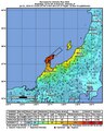 | 1,231 × 1,537 (3 MB) | Sapiann | Version 10: Processed 2024-03-09T18:30:39Z |
| 01:33, 9 February 2024 |  | 1,231 × 1,537 (3 MB) | Sapiann | Version 8: Processed 2024-01-31T19:30:49Z | |
| 07:09, 31 January 2024 |  | 1,231 × 1,537 (3 MB) | Sapiann | Version 7: Processed 2024-01-29T14:39:57Z | |
| 03:15, 3 January 2024 |  | 1,231 × 1,537 (2.99 MB) | Sapiann | Version 6: Processed 2024-01-02T18:15:09Z | |
| 09:02, 2 January 2024 | 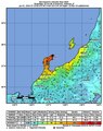 | 1,237 × 1,558 (2.8 MB) | Sapiann | Version 5: Processed 2024-01-02 T07:13:53Z | |
| 19:40, 1 January 2024 |  | 1,237 × 1,558 (2.8 MB) | Sapiann | Version 4: Processed 2024-01-01T19:06:40Z | |
| 09:37, 1 January 2024 | 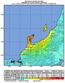 | 1,237 × 1,558 (2.79 MB) | Sapiann | Version 3: Processed 2024-01-01 T09:12:40Z | |
| 08:57, 1 January 2024 | 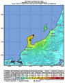 | 1,237 × 1,558 (2.78 MB) | Sapiann | Uploaded a work by from United States Geological Survey with UploadWizard |
The following other wikis use this file: