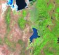
File:Utah Lake Landsat.png
Utah Lake
Click on a date/time to view the file as it appeared at that time.
| Date/Time | Thumbnail | Dimensions | User | Comment | |
|---|---|---|---|---|---|
| current | 07:13, 25 September 2007 |  | 566 × 529 (652 KB) | Nihonjoe | Landsat picture of Utah Lake near Provo, Utah. The southern end of the Great Salt Lake is visible at the top left corner of the image. |