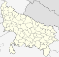
File:Uttar Pradesh Locator Map.svg
Click on a date/time to view the file as it appeared at that time.
| Date/Time | Thumbnail | Dimensions | User | Comment | |
|---|---|---|---|---|---|
| current | 03:11, 8 January 2021 |  | 909 × 886 (838 KB) | C1MM | Updated districts, made more accurate boundaries |
| 23:32, 6 March 2011 |  | 2,400 × 2,515 (137 KB) | Plasticspork | Use more neutral colouring | |
| 21:34, 5 November 2009 |  | 2,400 × 2,515 (137 KB) | File Upload Bot (Magnus Manske) | {{BotMoveToCommons|en.wikipedia|year={{subst:CURRENTYEAR}}|month={{subst:CURRENTMONTHNAME}}|day={{subst:CURRENTDAY}}}} {{Information |Description={{en|This map has been created by Faiz Haider, it is based on [http://india.gov.in/m |
File usage
The following 17 pages use this file:
- Administrative divisions of Uttar Pradesh
- Chak Gharpur
- Clean UP, Green UP
- Climate of Uttar Pradesh
- List of chief ministers of Uttar Pradesh
- List of cities in Uttar Pradesh by population
- List of districts of Uttar Pradesh
- List of urban agglomerations in Uttar Pradesh
- List of urban local bodies in Uttar Pradesh
- Noida ATS Shootout
- Pratapgarh stampede
- Urdu literature
- Uttar Pradesh
- Uttar Pradesh Tourism
- User:Faizhaider/gallery
- User talk:Planemad/Infobox Indian Landmark
- Template:Uttar Pradesh topics
Global file usage
The following other wikis use this file:
- Usage on ar.wikipedia.org
- اللغة الأردية
- اللغة الهندية
- أتر برديش
- الإمبراطورية الماورية
- إمبراطورية جوبتا
- سلطنة دلهي
- اللغة البوجبورية
- هارشا
- اللغة الهندستانية
- فيدا
- اللغة البرجية
- الأحزاب السياسية في الهند
- الإمبراطورية الكوشانية
- حركة الاستقلال الهندية
- مملكة ماجادها
- فترة فيدية
- نواب عوض
- شعر ملاحم هندية
- اللغات البهارية
- ماهاجانابادا
- موسيقى كلاسيكية هندوستانية
- أدب أردي
- كاثاك
- أدب سنسكريتي
- إمبراطورية ناندا
- حضارة المقبرة إتش
- إمبراطورية شونغا
- قالب:مواضيع أتر برديش
- Usage on awa.wikipedia.org
- Usage on bh.wikipedia.org
View more global usage of this file.