File:Venetian Causeway South Beach.jpg
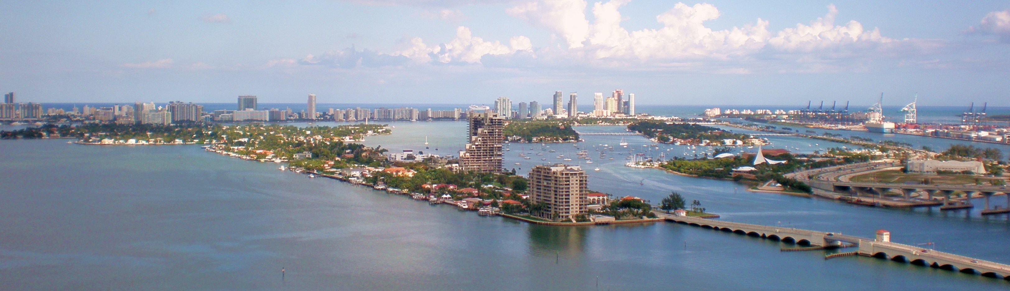
A droite, de l'avant vers l'arrière : Venetian Causeway depuis le coin en bas à droite (elle relie Miami derrière nous et Miami Beach sur la gauche hors champ, en passant par les îles vénitiennes) ; puis derrière elle la Watson Island avec la MacArthur Causeway formant un arrondi et qui se prolonge, piquetée d'arbres disséminés, vers le centre de la photo ; derrière, la Dodge Island avec des grues de levage.
Au centre : Biscayne Island, et derrière elle (dans l'axe de l'immeuble élevé en triangle) Hibiscus island, reliée par un pont à Star island sur sa droite (côté sud). Star island est elle-même reliée par un pont sur son côté sud à la MacArthur causeway.
Sur la gauche de Biscayne Island, desservies elles aussi par la Venetian causeway : San Marco island, puis Di Lido island, Rivo Alto island et Belle-Île island. Tout au fond, Miami Beach.
La ligne d'horizon des gratte-ciel a considérablemnt changé depuis la date de cette photo (2008) : voir la vue en 2023 sur Miami Beach depuis la Venetian causeway entre Rivo Alto et Belle-Île.
