File:Very Early Map Of Sydney From 1789.jpg
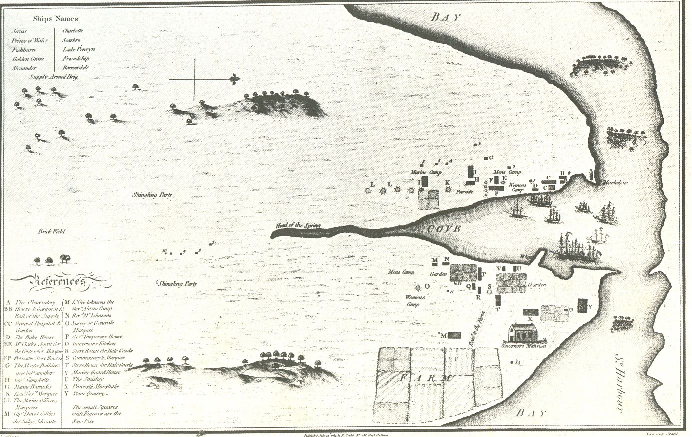
Cove 就是 Sydney Cove.也就是现在的环形码头那里. 这幅地图标示为右面是北,上面是西,当时的北悉尼海岸线画得很不准确,也没有任何文字地点标识,后来的悉尼港口大桥就将海湾上面西角的岩石区与北岸连接,悉尼歌剧院在海湾下面的那个东角上,FARM是现在的皇家植物园所在地.悉尼湾的河道(Head of spring)变成暗渠,一条名叫Bridge(桥)的街道对应原先海湾河道上过桥的马路。
A map of Sydney from 1789 done by a transported convict. very old - hence public domain
A map of Sydney from 1789 done by a transported convict. very old - hence public domain
Licensing
|
This work is in the public domain in its country of origin and other countries and areas where the copyright term is the author's life plus 70 years or fewer. | |
| This file has been identified as being free of known restrictions under copyright law, including all related and neighboring rights. | |