File:Victor Diamond Mine NASA Image.svg
Click on a date/time to view the file as it appeared at that time.
| Date/Time | Thumbnail | Dimensions | User | Comment | |
|---|---|---|---|---|---|
| current | 16:01, 6 October 2013 |  | 738 × 616 (531 KB) | Patrick87 | Adjust markings for "pits" |
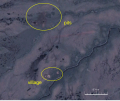
| 04:38, 6 October 2013 |  | 738 × 616 (531 KB) | Patrick87 | == {{int:filedesc}} == {{Information |Description={{en|1=NASA Landsat image of the Victor Diamond Mine in Northern Ontario. The three pits can be seen at the top of the image, as can the small village near the bottom.}} |Source=Derived from [[:File:Vic... |
File usage
The following page uses this file: