File:View Of Vicksburg.jpg
Original work
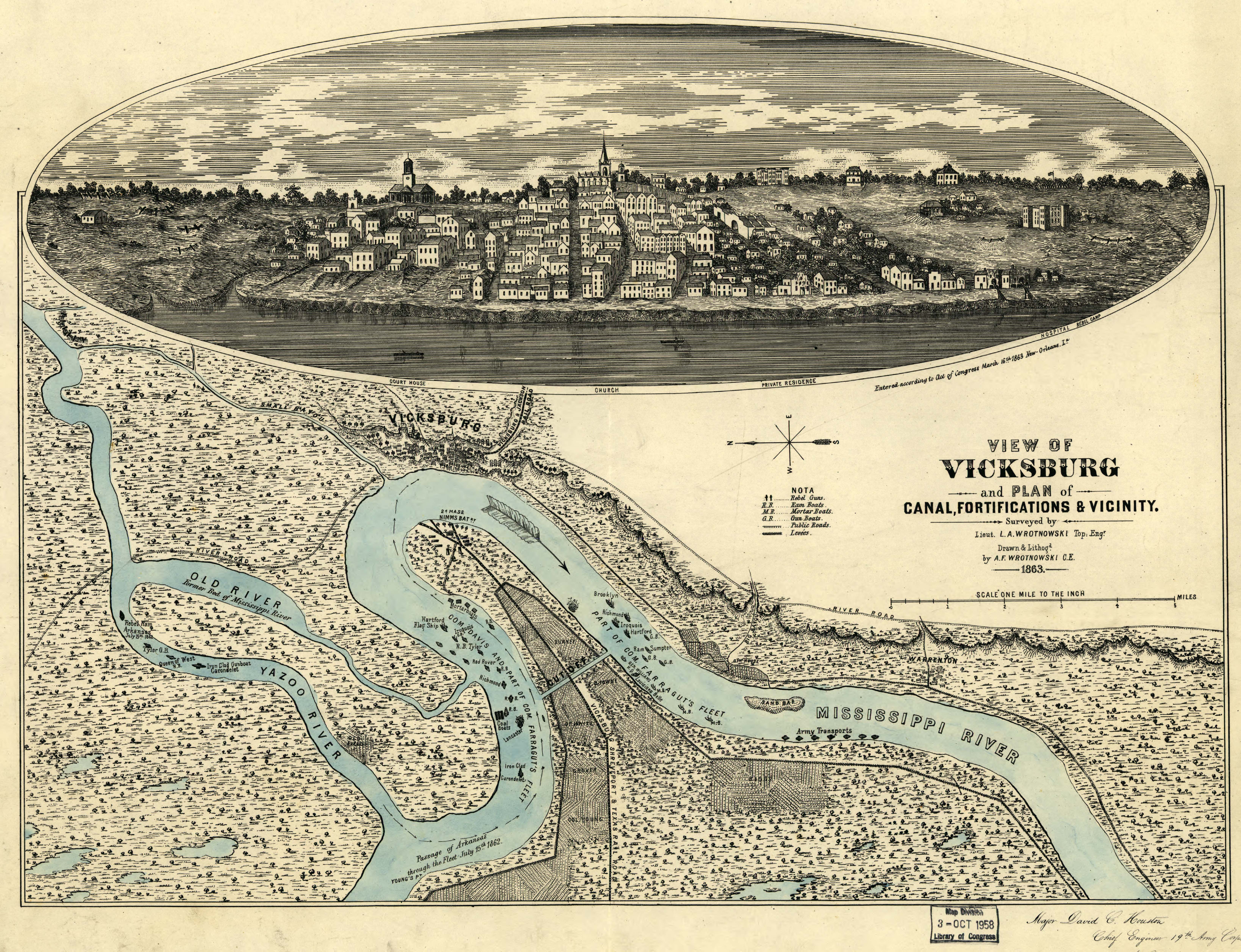
View of Vicksburg and plan of the canal, fortifications & vicinity Surveyed by Lieut. L. A. Wrotnowski, Top: Engr. Drawn & lithogd. by A. F. Wrotnowski C.E.
Wrotnowski, L. A.
CREATED/PUBLISHED [S.l.], 1863.
NOTES Scale 1:63,360.
Reference: LC Civil War Maps (2nd ed.), 294
Indicates fortifications, location, type and names of boats, roads, railroads, levees, drainage, vegetation, and the names of a few residents.
Inset: [View of Vicksburg] 17 x 54 cm.
Inscribed in the lower right hand corner "Major David C. Houston, Chief Engineer, 19th Army Corps, with the compliments from the author."
Description derived from published bibliography.
SUBJECTS
Vicksburg (Miss.)--History--Civil War, 1861-1865--Maps.
United States--Mississippi--Vicksburg.
MEDIUM 1 view, col., 40 x 54 cm.
CALL NUMBER G3984.V8S5 1863 .W7 CW 294
REPOSITORY Library of Congress Geography and Map Division Washington, D.C. 20540-4650
DIGITAL ID g3984v cw0294000 http://hdl.loc.gov/loc.gmd/g3984v.cw0294000
Licensing
This file is a work of a U.S. Army soldier or employee, taken or made as part of that person's official duties. As a work of the U.S. federal government, it is in the public domain in the United States.
|
 |