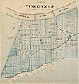
File:Vincennes, Indiana Map From 1876 Atlas.JPG
Click on a date/time to view the file as it appeared at that time.
| Date/Time | Thumbnail | Dimensions | User | Comment | |
|---|---|---|---|---|---|
| current | 21:06, 26 April 2012 |  | 1,501 × 1,600 (1.88 MB) | Omnedon | == {{int:filedesc}} == {{Information |Description=Map of w:Vincennes, Indiana, United States |Source=Illustrated Historical Atlas of the State of Indiana |Date=1876 |Author=Baskin, Forster and Company, Chicago |Permission= |other_versions= }} {{o... |
File usage
The following page uses this file:
Global file usage
The following other wikis use this file:
- Usage on de.wikipedia.org
- Usage on fr.wikipedia.org