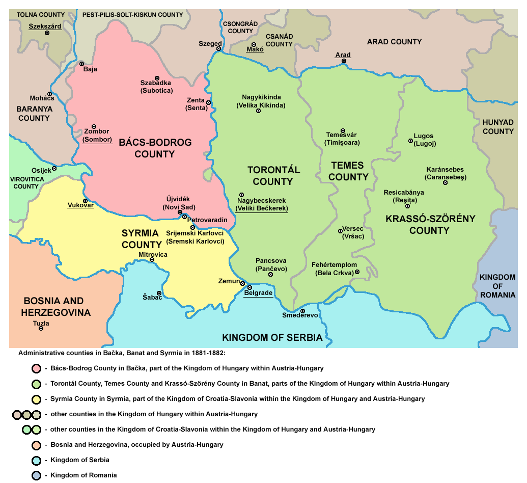
File:Vojvodina10.png
self made map by user PANONIAN
| This work has been released into the public domain by its author, PANONIAN at English Wikipedia. This applies worldwide. In some countries this may not be legally possible; if so: PANONIAN grants anyone the right to use this work for any purpose, without any conditions, unless such conditions are required by law. |
References
- Školski istorijski atlas, Zavod za izdavanje udžbenika SR Srbije, Beograd, 1970.
- Sve srpske mape - od šestog veka do Pariza, Specijalno izdanje BLICA, Decembar 1995
- Peter Rokai - Zoltan Đere - Tibor Pal - Aleksandar Kasaš, Istorija Mađara, Beograd, 2002.
- http://lazarus.elte.hu/~mihalyi/proba/Hungary%201881.jpg
- http://historicaltextarchive.com/hungary/map8.gif
- http://historicaltextarchive.com/hungary/map7.gif
- http://laszlorex.hu/sztlaszlo/terkep.jpg
- http://www.ujszeged.hu/kepek/Magyar_Kiralysag_terkep.jpg
Original upload log
The original description page was here. All following user names refer to en.wikipedia.
- 2005-12-06 14:21 PANONIAN 600×420×8 (120437 bytes)


