Click on a date/time to view the file as it appeared at that time.
| Date/Time | Thumbnail | Dimensions | User | Comment |
|---|
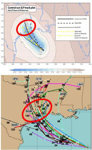
| current | 21:49, 5 March 2010 |  | 311 × 504 (51 KB) | Atmoz | {{Information |Description={{en|1=(Top): WRF model simulation of Hurricane Rita tracks. The model resolution is 30km. The colored field shows the lowest sea-level pressure (SLP) recorded during the last 27 hours of a 54 hour control simulation of Rita usi |
The following other wikis use this file:
- Usage on el.wikipedia.org
- Usage on fa.wikipedia.org
- Usage on fr.wikipedia.org
- Usage on sr.wikipedia.org
This file contains additional information, probably added from the digital camera or scanner used to create or digitize it.
If the file has been modified from its original state, some details may not fully reflect the modified file.
