Click on a date/time to view the file as it appeared at that time.
| Date/Time | Thumbnail | Dimensions | User | Comment |
|---|
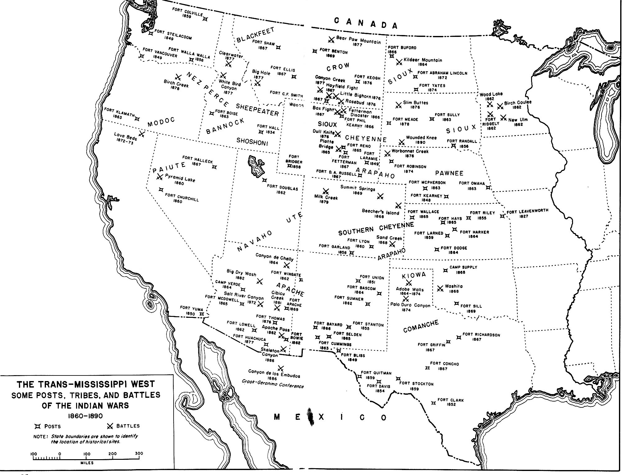
| current | 01:35, 26 July 2009 |  | 2,006 × 1,532 (425 KB) | Fred Bauder | {{Information |Description={{en|1=A map of the En:Indian Wars in the Western United States showing the general location of tribes and the location of some army posts and battles. Map 35 in Chapter 14 Winning the West: The Army in the Indian Wars, 1865 |
The following other wikis use this file:
- Usage on ar.wikipedia.org
- Usage on ca.wikipedia.org
- Usage on en.wikiquote.org
- Usage on fr.wikipedia.org
- Usage on pt.wikipedia.org
- Usage on sv.wikipedia.org
- Usage on tr.wikipedia.org
- Usage on uk.wikipedia.org
This file contains additional information, probably added from the digital camera or scanner used to create or digitize it.
If the file has been modified from its original state, some details may not fully reflect the modified file.
