File:Windy Fire Smoke Satellite View.jpg
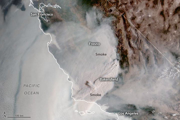
On the morning of September 24, 2021, the Geostationary Operational Environmental Satellite 17 (GOES-17) captured this natural-color image of vast plumes of smoke streaming from the fires and smothering Southern California."
NASA Earth Observatory image by Joshua Stevens, using GOES 17 imagery courtesy of NOAA and the National Environmental Satellite, Data, and Information Service (NESDIS). Caption by Adam Voiland.
