Click on a date/time to view the file as it appeared at that time.
| Date/Time | Thumbnail | Dimensions | User | Comment |
|---|
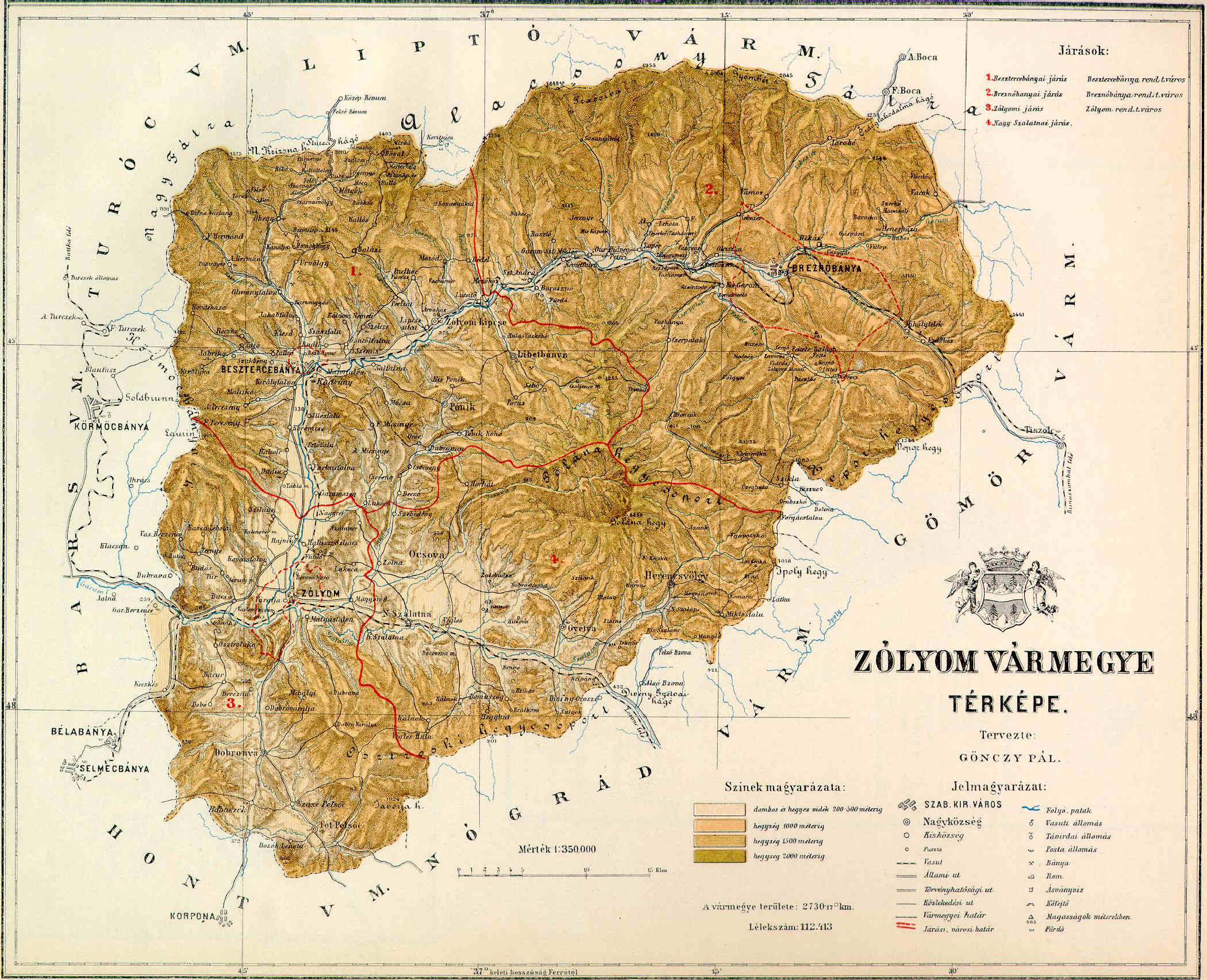
| current | 21:42, 10 November 2006 |  | 2,100 × 1,705 (508 KB) | PM | {{Information |Description=County of Zólyom in the pre-Trianon Kingdom of Hungary. <br>Komitat Zólyom w Królestwie Węgier przed traktatem w Trianon. |Source=hu:Kép:Zólyom vármegye térképe.jpg uploaded by hu:User:Kla |Date=not given (1 |
The following page uses this file:
The following other wikis use this file:
- Usage on cs.wikipedia.org
- Usage on de.wikipedia.org
- Usage on eo.wikipedia.org
- Usage on fr.wikipedia.org
- Usage on hu.wikipedia.org
- Usage on it.wikipedia.org
- Usage on nl.wikipedia.org
- Usage on pl.wikipedia.org
- Usage on ro.wikipedia.org
- Usage on sk.wikipedia.org
This file contains additional information, probably added from the digital camera or scanner used to create or digitize it.
If the file has been modified from its original state, some details may not fully reflect the modified file.
 You must also include a United States public domain tag to indicate why this work is in the public domain in the United States.