Gosnold, Massachusetts
History
The earliest inhabitants of the Elizabeth Islands were the Wampanoag Native Americans. The tribe did not settle permanently on the Elizabeth Islands, but used them in summer for hunting, fishing, and gardening. Occasionally, arrowheads or stone tools are discovered on the islands. The islands' names come from the Wampanoag language.
Bartholomew Gosnold was among the first Europeans to become aware of the Elizabeth Islands, including Cuttyhunk, in 1602. He and his crew attempted to establish a trading post on Cuttyhunk so that they could trade with the natives, the first attempt by Europeans to do so. The trading post was abandoned after only a few weeks, and Gosnold decided to return home. Upon his return to England, the British Crown claimed jurisdiction of the island chain.
Gosnold was first settled in 1641, the year of purchase of the islands by Thomas Mayhew, Sr. The islands were claimed by the Wampanoag until 1658, when the Wampanoag sachem transferred the deed of ownership to Mayhew. Constituting Dukes County, New York since 1683, the Elizabeth Islands, Martha's Vineyard, and Nantucket, were transferred to the newly created Province of Massachusetts Bay in 1691. Gosnold was separately incorporated as a municipality in 1864; previously it was a part of the town of Chilmark.
Geography
According to the United States Census Bureau, the town has a total area of 140.2 square miles (363.0 km), of which 13.2 square miles (34.2 km) is land and 127.0 square miles (328.9 km), or 90.59%, is water. Gosnold ranks 272nd out of the 351 communities in the Commonwealth in terms of land area; however, it has the longest distance between points within municipal limits of any town in the Commonwealth of Massachusetts. It consists of the Elizabeth Islands, including Nonamesset Island, Uncatena Island, Naushon Island, Pasque Island, Nashawena Island, Penikese Island, Cuttyhunk Island, and several smaller islands. The string of islands extend roughly southwest of the southwestern tip of Falmouth, with the closest island, Nonamesset, being less than one-third of a mile away at its closest point. More than half the population lives on Cuttyhunk, with the majority of the rest living on Naushon.
Transportation
Transportation to the island of Cuttyhunk is served by Cuttyhunk Ferry Company from New Bedford. Service is daily in the warm months, and on Monday and Friday in the cooler months. There is also a water taxi service between New Bedford and Cuttyhunk.
Naushon Island is served by a private ferry from Woods Hole. The islands of Nonamesset and Uncatena are connected to Naushon Island via bridges that can be crossed by foot.
Penikese Island is accessible via a chartered boat for STEM-related school trips.
All other remaining islands in the town of Gosnold do not have regular / publicized boat service and require a private vessel to be reached.
Demographics
| Year | Pop. | ±% |
|---|---|---|
| 1870 | 99 | — |
| 1880 | 152 | +53.5% |
| 1890 | 135 | −11.2% |
| 1900 | 164 | +21.5% |
| 1910 | 152 | −7.3% |
| 1920 | 181 | +19.1% |
| 1930 | 120 | −33.7% |
| 1940 | 136 | +13.3% |
| 1950 | 56 | −58.8% |
| 1960 | 66 | +17.9% |
| 1970 | 83 | +25.8% |
| 1980 | 63 | −24.1% |
| 1990 | 98 | +55.6% |
| 2000 | 86 | −12.2% |
| 2010 | 75 | −12.8% |
| 2020 | 70 | −6.7% |
| 2022* | 64 | −8.6% |
| * = population estimate. Source: United States Census records and Population Estimates Program data. | ||
As of the census of 2020, there were 70 people and 26 households residing in the town. The population density was 5.3 inhabitants per square mile (2.0/km). There were 218 housing units at an average density of 16.5 per square mile (6.4/km). The racial makeup of the town was 61 (87.14%) White, 3 (4.29%) Hispanic or Latino, 3 (4.29%) African Americans, Native Americans, and 5 (7.14%) from two or more races. The census did not report any Asians, or Pacific Islanders, and reported one person as Some Other Race.
In the town, the population was made up entirely of adults. 36.7% who were 65 years of age or older.
According to the 2010 Census, Gosnold now has the lowest population density of any town in the Commonwealth. The title was previously held by Mount Washington at the southwest corner of Massachusetts.
Gosnold was first in a 2008 ranking of all Massachusetts communities in terms of total value of real estate per resident.
Government and politics
Government
On the national level, Gosnold is a part of Massachusetts's 9th congressional district, and is currently represented by Democrat Bill Keating. Massachusetts is currently represented in the United States Senate by senior Senator (Democrat) Elizabeth Warren and junior Senator (Democrat) Ed Markey.
On the state level, Gosnold is represented in the Massachusetts House of Representatives as a part of the Barnstable, Dukes and Nantucket district, which includes all of Martha's Vineyard and Nantucket, as well as a portion of Falmouth. The town is represented in the Massachusetts Senate as a portion of the Cape and Islands district, which includes all of Martha's Vineyard, Nantucket and most of Barnstable County (with the exception of Bourne, Sandwich, and Falmouth). All of Dukes County is patrolled by the Fifth (Oak Bluffs) Barracks of Troop D of the Massachusetts State Police.
Gosnold is governed on the local level by the open town meeting form of government, and is led by a board of selectmen. Due to its geographic isolation and small population, the town has at times asked for a waiver from the Commonwealth from anti-nepotism laws.
Political affiliation
| Registered Voters and Party Enrollment as of October 29, 2022 | |||||
|---|---|---|---|---|---|
| Party | Number of Voters | Percentage | |||
| Unenrolled | 64 | 64% | |||
| Democratic | 20 | 20% | |||
| Republican | 15 | 15% | |||
| Total | 100 | 100% | |||
Politics
| Year | Democratic | Republican | Third Parties |
|---|---|---|---|
| 2024 | 76.1% 51 | 22.4% 15 | 1.5% 1 |
| 2020 | 68.3% 56 | 26.8% 22 | 4.9% 4 |
| 2016 | 50.7% 36 | 38.0% 27 | 7.4% 5 |
| 2012 | 56.3% 49 | 41.4% 36 | 2.3% 2 |
| 2008 | 65.0% 52 | 32.5% 26 | 2.5% 2 |
| 2004 | 53.3% 41 | 44.2% 34 | 2.6% 2 |
| 2000 | 48.2% 39 | 40.7% 33 | 11.1% 9 |
| 1996 | 50.6% 46 | 23.1% 21 | 13.2% 12 |
| 1992 | 40.4% 42 | 28.9% 30 | 30.8% 32 |
| 1988 | 48.5% 50 | 50.5% 52 | 1.0% 1 |
| 1984 | 29.1% 23 | 70.9% 56 | 2.2% 0 |
| 1980 | 23.7% 18 | 46.1% 35 | 30.1% 23 |
| 1976 | 23.0% 17 | 68.9% 51 | 5.4% 4 |
| 1972 | 16.4% 10 | 77.1% 47 | 2.2% 0 |
| 1968 | 31.4% 16 | 66.7% 34 | 1.9% 1 |
| 1964 | 54.8% 23 | 45.2% 19 | 2.2% 0 |
| 1960 | 21.7% 10 | 78.3% 36 | 2.2% 0 |
| 1956 | 8.8% 6 | 91.2% 62 | 0.0% 0 |
| 1952 | 14.7% 9 | 85.3% 52 | 0.0% 0 |
| 1948 | 31.0% 13 | 69.0% 29 | 0.0% 0 |
| 1944 | 37.8% 14 | 62.2% 23 | 0.0% 0 |
| 1940 | 34.9% 15 | 65.1% 28 | 0.0% 0 |
| 1936 | 28.8% 15 | 71.2% 37 | 0.0% 0 |
| 1932 | 43.8% 21 | 56.2% 27 | 0.0% 0 |
| 1928 | 20.0% 11 | 80.0% 44 | 0.0% 0 |
| 1924 | 4.1% 2 | 95.9% 47 | 0.0% 0 |
| 1920 | 22.2% 10 | 77.8% 35 | 0.0% 0 |
| 1916 | 15.2% 5 | 84.8% 23 | 0.0% 0 |
| 1912 | 12.1% 4 | 51.5% 17 | 36.4% 12 |
| 1908 | 10.3% 3 | 86.2% 25 | 3.5% 1 |
| 1904 | 12.5% 2 | 81.3% 13 | 6.2% 1 |
| 1900 | 13.0% 3 | 82.6% 19 | 4.4% 1 |
| 1896 | 0.0% 0 | 100.0% 17 | 0.0% 0 |
| 1892 | 31.0% 9 | 65.5% 19 | 3.5% 1 |
| 1888 | 35.0% 7 | 65.0% 13 | 0.0% 0 |
| 1884 | 42.9% 9 | 57.1% 12 | 0.0% 0 |
| 1880 | 0.0% 0 | 100.0% 19 | 0.0% 0 |
| 1876 | 0.0% 0 | 100.0% 15 | 0.0% 0 |
| 1872 | 0.0% 0 | 100.0% 14 | 0.0% 0 |
| 1868 | 0.0% 0 | 100.0% 18 | 0.0% 0 |
| Year | Democratic | Republican | Third Parties |
|---|---|---|---|
| 2022 | 73.6% 39 | 24.5% 13 | 1.9% 1 |
| 2018 | 23.2% 13 | 76.8% 43 | 0.0% 0 |
| 2014 | 43.5% 20 | 52.2% 24 | 2.2% 1 |
| 2010 | 41.2% 28 | 50.0% 34 | 8.8% 6 |
| 2006 | 52.5% 31 | 44.1% 26 | 3.4% 2 |
| 2002 | 40.0% 20 | 54.0% 27 | 6.0% 3 |
| 1998 | 38.5% 25 | 50.8% 33 | 4.6% 3 |
| 1994 | 23.9% 17 | 73.2% 52 | 2.8% 2 |
| 1990 | 39.3% 33 | 56.0% 47 | 3.6% 3 |
| 1986 | 71.2% 42 | 27.1% 16 | 0.0% 0 |
| 1982 | 44.3% 27 | 49.2% 30 | 6.6% 4 |
| 1978 | 33.3% 16 | 64.6% 31 | 2.1% 1 |
| 1974 | 31.9% 15 | 63.8% 30 | 2.1% 1 |
| 1970 | 11.1% 5 | 86.7% 39 | 0.0% 0 |
Education
The town has one schoolhouse, Cuttyhunk Elementary School. As of 2020, the school has no students. However, the town hopes to use the school as a STEM resource center for mainland schools to visit.
Penikese Island is home to The Penikese School. It operated as a private school for troubled boys until 2011. The school then became a substance abuse treatment center for a short time before converting into an educational facility for field trips.
References
- ^ "Census - Geography Profile: Gosnold town, Dukes County, Massachusetts". U.S. Census Bureau. Retrieved November 7, 2021.
- ^ Elias Nason; George J. Varney (1890). "Gosnold, Massachusetts 1890". A Gazetteer of the State of Massachusetts with Numerous Illustrations. Publisher: B.B. Russell. pp. 334–336.
- ^ "Geographic Identifiers: 2010 Demographic Profile Data (G001): Gosnold town, Dukes County, Massachusetts". U.S. Census Bureau, American Factfinder. Archived from the original on February 13, 2020. Retrieved October 29, 2015.
- ^ "1990 Census of Population, General Population Characteristics: Massachusetts" (PDF). US Census Bureau. December 1990. Table 76: General Characteristics of Persons, Households, and Families: 1990. 1990 CP-1-23. Archived from the original (PDF) on December 7, 2013. Retrieved July 12, 2011.
- ^ "1980 Census of the Population, Number of Inhabitants: Massachusetts" (PDF). US Census Bureau. December 1981. Table 4. Populations of County Subdivisions: 1960 to 1980. PC80-1-A23. Retrieved July 12, 2011.
- ^ "1950 Census of Population" (PDF). 1: Number of Inhabitants. Bureau of the Census. 1952. Section 6, Pages 21-10 and 21-11, Massachusetts Table 6. Population of Counties by Minor Civil Divisions: 1930 to 1950. Retrieved July 12, 2011.
{{cite journal}}: Cite journal requires|journal=(help) - ^ "1920 Census of Population" (PDF). Bureau of the Census. Number of Inhabitants, by Counties and Minor Civil Divisions. Pages 21-5 through 21-7. Massachusetts Table 2. Population of Counties by Minor Civil Divisions: 1920, 1910, and 1920. Retrieved July 12, 2011.
- ^ "1890 Census of the Population" (PDF). Department of the Interior, Census Office. Pages 179 through 182. Massachusetts Table 5. Population of States and Territories by Minor Civil Divisions: 1880 and 1890. Retrieved July 12, 2011.
- ^ "1870 Census of the Population" (PDF). Department of the Interior, Census Office. 1872. Pages 217 through 220. Table IX. Population of Minor Civil Divisions, &c. Massachusetts. Retrieved July 12, 2011.
- ^ "City and Town Population Totals: 2020−2022". United States Census Bureau. Retrieved November 25, 2023.
- ^ "U.S. Census website". United States Census Bureau. Retrieved February 4, 2022.
- ^ "Massachusetts total residential values per resident, 2008". The Boston Globe. January 21, 2010.
- ^ "Index of Legislative Representatives by City and Town". Archived from the original on September 29, 2007. Retrieved March 20, 2007.
- ^ "Mass.gov". www.mass.gov.
- ^ "Spokane Chronicle - Google News Archive Search".
- ^ "Registered Voters and Party Enrollment as of October 24, 2024" (PDF). Massachusetts Elections Division. Retrieved November 24, 2024.
- ^ "PD43+ » Massachusetts Election Results and Statistics". PD43+.
- ^ "Election statistics, the Commonwealth of Massachusetts".
- ^ "Election statistics, the Commonwealth of Massachusetts". 1964.
- ^ "Election statistics, the Commonwealth of Massachusetts".
- ^ "Election statistics, the Commonwealth of Massachusetts". 1956.
- ^ "Election statistics, the Commonwealth of Massachusetts". 1952.
- ^ "Election statistics".
- ^ "Election statistics".
- ^ "Election statistics".
- ^ "Election statistics".
- ^ "Election statistics".
- ^ "A manual for the use of the General Court (1929)". December 30, 1929. hdl:2452/40703. Archived from the original on July 27, 2020. Retrieved July 13, 2024 – via archives.lib.state.ma.us.
- ^ "A manual for the use of the General Court (1925)". December 30, 1925. hdl:2452/40701. Archived from the original on July 27, 2020. Retrieved July 13, 2024 – via archives.lib.state.ma.us.
- ^ "A manual for the use of the General Court (1921)". December 30, 1921. hdl:2452/40699. Archived from the original on May 19, 2020. Retrieved July 13, 2024 – via archives.lib.state.ma.us.
- ^ "A manual for the use of the General Court (1917)". December 30, 1917. hdl:2452/40695. Archived from the original on May 19, 2020. Retrieved July 13, 2024 – via archives.lib.state.ma.us.
- ^ "A manual for the use of the General Court (1913)". December 30, 1913. hdl:2452/40691. Archived from the original on July 27, 2020. Retrieved July 13, 2024 – via archives.lib.state.ma.us.
- ^ "A manual for the use of the General Court (1909)". December 30, 1909. hdl:2452/40687. Archived from the original on May 19, 2020. Retrieved July 13, 2024 – via archives.lib.state.ma.us.
- ^ "A manual for the use of the General Court (1905)". December 30, 1905. hdl:2452/40683. Archived from the original on May 19, 2020. Retrieved July 13, 2024 – via archives.lib.state.ma.us.
- ^ "A manual for the use of the General Court (1901)". December 30, 1901. hdl:2452/40679. Archived from the original on May 19, 2020. Retrieved July 13, 2024 – via archives.lib.state.ma.us.
- ^ "A manual for the use of the General Court (1897)". December 30, 1897. hdl:2452/40675. Archived from the original on May 19, 2020. Retrieved July 13, 2024 – via archives.lib.state.ma.us.
- ^ "A manual for the use of the General Court (1893)". December 30, 1893. hdl:2452/40671. Archived from the original on May 19, 2020. Retrieved July 13, 2024 – via archives.lib.state.ma.us.
- ^ "A manual for the use of the General Court (1889)". December 30, 1889. hdl:2452/40667. Archived from the original on May 19, 2020. Retrieved July 13, 2024 – via archives.lib.state.ma.us.
- ^ "A manual for the use of the General Court (1885)". December 30, 1885. hdl:2452/40663. Archived from the original on May 19, 2020. Retrieved July 13, 2024 – via archives.lib.state.ma.us.
- ^ "A manual for the use of the General Court (1881)". December 30, 1881. hdl:2452/40659. Archived from the original on May 19, 2020. Retrieved July 13, 2024 – via archives.lib.state.ma.us.
- ^ "A manual for the use of the General Court (1877)". December 30, 1877. hdl:2452/40655. Archived from the original on May 19, 2020. Retrieved July 13, 2024 – via archives.lib.state.ma.us.
- ^ "A manual for the use of the General Court (1873)". December 30, 1873. hdl:2452/40651. Archived from the original on May 19, 2020. Retrieved July 13, 2024 – via archives.lib.state.ma.us.
- ^ "A manual for the use of the General Court (1869)". December 30, 1869. hdl:2452/40647. Archived from the original on May 19, 2020. Retrieved July 13, 2024 – via archives.lib.state.ma.us.
- ^ "Cuttyhunk Elementary graduates its last student". June 17, 2019.
- ^ "Penikese Island History and Fun Facts | Penikese Island School". Retrieved November 19, 2019.
- ^ "Penikese Island Mission Reinvigorated With Education". capenews.net. August 2, 2019. Retrieved April 10, 2022.
Further reading
- The Cuttyhunk Historical Society. (2002). Images of America: Cuttyhunk and the Elizabeth Islands. Charleston, SC: Arcadia Publishing. ISBN 0-7385-0980-9.
External links
- The Town of Gosnold, Dukes County Official Page
- Images of Cuttyhunk Island
- Images of Hadley's Harbor
- Cuttyhunk Historical Society; The Museum of the Elizabeth Islands
Municipalities and communities of Dukes County, Massachusetts, United States | ||
|---|---|---|
| Towns | 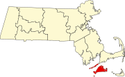 | |
| CDPs | ||
| Other villages | ||
| Indian reservation | ||