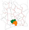
Guibéroua
Guibéroua is a town in south-central Ivory Coast. It is a sub-prefecture and commune of Gagnoa Department in Gôh Region, Gôh-Djiboua District.
Villages
The 23 villages of the sub-prefecture of Gagnoa and their population in 2014 are:
- Basséhoa (2,349)
- Bassi (1,276)
- Bélam (1,921)
- Béliéhoa (2,615)
- Bilahio (4,018)
- Briéhoa (2,370)
- Djétéhoa (1,328)
- Grand-Zia (3,188)
- Guézem (1,821)
- Guibéroua (18,029)
- Kabéhoa (1,596)
- Konahio (2,085)
- Kpogrobouo (1,994)
- Krissérahio (909)
- Lébam (824)
- Niaprahio 1(,568)
- Ondjahio (1,931)
- Takoa (1,306)
- Zadiahio (2,441)
- Zakoa (927)
- Ziriwa (2,008)
- Zohoa (6,594)
- Zoukoubré (1,186)
Climate
| Climate data for Guibéroua | |||||||||||||
|---|---|---|---|---|---|---|---|---|---|---|---|---|---|
| Month | Jan | Feb | Mar | Apr | May | Jun | Jul | Aug | Sep | Oct | Nov | Dec | Year |
| Mean daily maximum °C (°F) | 34.1 (93.4) |
35.1 (95.2) |
35.1 (95.2) |
34.3 (93.7) |
33.3 (91.9) |
31.6 (88.9) |
30.4 (86.7) |
30.2 (86.4) |
31.4 (88.5) |
32.5 (90.5) |
33.1 (91.6) |
32.9 (91.2) |
32.8 (91.1) |
| Mean daily minimum °C (°F) | 20.6 (69.1) |
22.7 (72.9) |
22.9 (73.2) |
23 (73) |
22.9 (73.2) |
22.4 (72.3) |
21.8 (71.2) |
21.6 (70.9) |
22.2 (72.0) |
22.5 (72.5) |
22.4 (72.3) |
22.1 (71.8) |
22.3 (72.0) |
| Average rainy days (≥ 1 mm) | 1 | 5 | 10 | 11 | 12 | 13 | 8 | 7 | 11 | 14 | 9 | 2 | 103 |
| Source: Storm247 | |||||||||||||
References
- ^ Citypopulation.de Population of cities & localities in Ivory Coast
- ^ Citypopulation.de Population of the regions and sub-prefectures of Ivory Coast
- ^ "Localities in Guibéroua (Gôh-Djiboua District, Ivory Coast) - Population Statistics, Charts, Map, Location, Weather and Web Information". www.citypopulation.de. Retrieved 2024-09-15.
- ^ "Weather for Guibéroua, Ivory Coast - Climate". Storm247. Archived from the original on 2013-12-04. Retrieved 2013-12-04.
