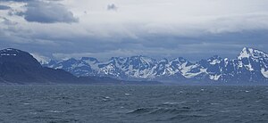
Kangerlussuaq Fjord
Geography
The head of the fjord is located at 67°00′18″N 50°41′35″W / 67.00500°N 50.69306°W, at the estuary of the Qinnguata Kuussua river flowing from the Russell Glacier of the Greenland ice sheet (Greenlandic: Sermersuaq). The fjord mouth is located at 66°01′40″N 53°32′00″W / 66.02778°N 53.53333°W, south of the Simiutaq Island. Another, smaller waterway connects to the sea to the north of the island.
Kangerlussuaq Fjord does not have any tributary fjords, with a fairly uniform coastline. Small hills of the Kangaamiut dike swarm, such as the highlands of Tarajornitsut, dominate the coast of the inner parts of the fjord, transforming into steep mountain ranges towards the mouth. In that it is different from fjords of Norway, or indeed many other fjords in Greenland, the coast of which is flanked by progressively smaller mountains.
Alluvial sediments from Qinnguata Kuussua, which carries meltwater from the ice sheet give rise to a distinct emerald coloring of the fjord waters for several kilometers from the fjord head. Silt accumulation at the estuary formed patches of quicksand of variable size up to a kilometer into the fjord.
This fjord marks the border between the two geographic regions of Queen Ingrid Land and King Frederick IX Land.
 |
Settlement
The only settlement on the shores of the fjord is Kangerlussuaq, located just north of the river estuary at the head of the fjord. Kangaamiut is located on a small island, on the shores of Davis Strait, approximately 26 km (16 mi) south of the fjord mouth.
Transport
The fjord is navigable in its entire length. Cruise ships, such as Norway's Hurtigruten and supply ships of Royal Greenland navigate the fjord, mooring at the Kangerlussuaq port, west of Kangerlussuaq Airport.
References
- ^ Encyclopædia Britannica. "Kangerlussuaq". Retrieved 2010-04-26.
- ^ Vandrekort Vestgrønland: Kangerlussuaq (Map) (1996 ed.). Cartography by Compukort, Denmark. Greenland Tourism a/s.
- ^ Maniitsoq, Saga Map, Tage Schjøtt, 1992
- ^ Hansen, Kaj (1970). Geological and Geographical Investigations in Kong Frederik IX's Land: Morphology, Sediments, Periglacial Processes and Salt Lakes. C. A. Reitzel. ISBN 9788742100226.
- ^ "Hurtigruten.co.uk". Archived from the original on 2010-05-09. Retrieved 2010-04-26.
- ^ sisimiut.gl
External links
 Media related to Kangerlussuaq Fjord at Wikimedia Commons