Kew Gardens Hills, Queens
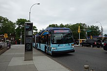
The neighborhood is located near several highways including the Long Island Expressway, Grand Central Parkway, Van Wyck Expressway, and the Jackie Robinson Parkway (Interborough). It is also served by several bus routes. Adjacent neighborhoods include Forest Hills to the west, Hillcrest to the east, Briarwood to the south, and Queensboro Hill to the north.
Kew Gardens Hills is located in Queens Community District 8 and its ZIP Code is 11367. It is patrolled by the New York City Police Department's 107th Precinct. Politically, Kew Gardens Hills is represented by the New York City Council's 24th District.
Geography
Kew Gardens Hills is situated in the southwestern corner of the area historically known as the Town of Flushing, in its 6th district.
As neighborhoods in the City of New York are not designated by the city, there are multiple means to determine the geographical boundaries of the area:
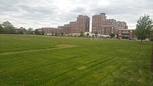
- General borders: The western boundary of the neighborhood is considered to be Flushing Meadows–Corona Park, which is separated from the neighborhood by the Van Wyck Expressway. The southern playground of the park however is east of the Van Wyck Expressway, and is only accessible via an entrance along Park Drive East. Though part of the park, the playground is considered within Kew Gardens Hills. Prior to the building of the Van Wyck Expressway, the IND World's Fair Line ran along this route during the 1939 New York World's Fair.
- Postal boundaries: Since 2003, when the United States Postal Services renamed the post office in ZIP Code 11367 to the "Kew Gardens Hills Post Office", the borders of the area for ZIP Code purposes extend from the south at Union Turnpike, to the north at the Horace Harding Expressway and east to Parsons Boulevard. Prior to 2003 this Post office was called the Station C Post Office. Although the post office is named "Kew Gardens Hills", the USPS still designates the city or town for purposes of addressing as "Flushing".
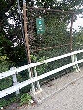
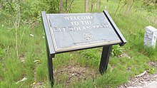
Boundary sign located over Flushing Meadows-Corona Park demarcating an Eruv boundary of Kew Gardens Hills - Other designations: Some areas, east of Parsons Boulevard and west of 164th Street, as well as south of Union Turnpike and north of the Grand Central Parkway are included in Kew Gardens Hills, by the NYC Department of Education, historians, the Kew Gardens Hills Eruv Committee, by residents or businesses themselves, or by real estate brokers.In these extended areas—with the exception of some zig-zag borders—residents north of 73rd Avenue use ZIP 11365, south of 73rd Avenue, ZIP 11366, and south of Union Turnpike, ZIPs 11432 and 11435. These areas include the Pomonok, Electchester, and Parkway Village developments, among others. Despite the ZIP Codes with the first three digits as "114" being originally designated in the postal city of "Jamaica", these areas of Kew Gardens Hills are within the geographical limits of the original Town of Flushing. The present 164th Street runs along the original border between the 4th and 6th districts of the town of Flushing.
Adjacent neighborhoods include Forest Hills to the west, Hillcrest and Pomonok to the east, Briarwood to the south, and Queensboro Hill to the north.
History
Early settlement
In the northwestern part of the neighborhood was the location of the 120 acres (49 ha) Spring Hill Farm. The farm was part of the Francis Lewis estate during colonial times. By 1762 the farm was owned by Colonel Thomas Willet, High Sheriff of Flushing, and was sold to Cadwallader Colden, lieutenant governor for the Province of New York. In 1763 Colden built the Spring Hill House on the property. In 1783 the property was confiscated by the government because Cadwallader's son David was a loyalist to the monarchy. By 1894 the Durkee family owned the property and sold it to the Cedar Grove Cemetery Corporation. The Spring Hill House became the office of the Cedar Grove Cemetery, until the house was later destroyed by a fire.
In the 19th century the area of Kew Gardens Hills was known as Head of the Fly, for its location at the headwaters of the Flushing Creek (or Flushing River). Fly or vly, being the Dutch word for swamp. One of the oldest roads through the area was called the Vleigh Road, and still exists today as Vleigh Place.
Timothy Jackson operated a horse boarding stable near where the intersection of Park Drive East and Union Turnpike, or the Kew Gardens Interchange is today. On what is now the Jamaica subway yard was previously a horse race course, built by Timothy Jackson, and was known as Whitepot Race & Track. Although the train yard is not in Jamaica, it is named Jamaica because the yard feeds the subway lines which begin (or end) in Jamaica. This area was an extension of Timothy Jackson's Willow Glen Farm for which the farmhouse was located south of Union Turnpike in the neighborhood of Jamaica that is now called Briarwood. In the 1750s, William Furman was the owner of the farm he named Willow Glen. Today Willow Lake, at the southern end of Flushing Meadows–Corona Park, retains the Willow name.
The municipal government of the Town of Flushing, which dated back to colonial times, along with other municipal township governments in Queens County, was incorporated into the Borough of Queens on January 1, 1898. Later, the area, was named after Kew Gardens, which in 1909 was renamed after Royal Botanic Gardens, Kew in London, England in the United Kingdom.
The area's earliest modern homes were built in 1917 off Union Turnpike, but in the early 20th century, the area was known as Queens Valley and consisted mostly of farmland. By the 1920s many of the farms were sold to golf clubs or country clubs. The golf courses that made up the area include the Spring Hill Golf Course, Queens Valley Golf Course, Pomonok Country Club, and Arrowbrook Country Club. In 1939, the Arrowbrook Country Club was the home of the "Summer City Hall" of Mayor La Guardia.
One road that ran through the area was called Quarrelsome Lane., which ran from Jamaica Road to Fresh Meadow Road; the road is now known as 75th Avenue. Jamaica Road, the most direct route between the villages of Flushing and Jamaica, is now Kissena Boulevard and becomes Parsons Boulevard at the intersection of Quarrelsome Lane.
Later years
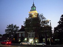
Growth to Kew Gardens Hills came when Kew Gardens, Queens, to the south, gained a subway line at Queens Boulevard in 1936 and Flushing Meadows–Corona Park, directly to the northwest of the neighborhood, hosted the 1939 New York World's Fair. Early residents were mostly German, Irish and Italian. Many were relocating from Brooklyn and Manhattan. The area was hilly and Kew Gardens was known as a prestigious Queens neighborhood and so developers changed its name from Queens Valley to Kew Gardens Hills.
The first Queen of Peace mass took place in 1939. Property along 144th Street, now part of Main Street, was seized by the city to complete the construction of Main Street from northern Flushing. Main Street was paved and bus routes began to serve the area in 1941. The Jewish Center of Kew Gardens Hills was established in 1941. The Queens County Savings Bank opened its branch in 1949 and local school, P.S. 164, also known as the Queens Valley School, also opened its doors that year.
Main Street Cinemas—designed by architect Joseph Unger, who also designed the Trylon Theatre—opened in 1940 and operated by Interboro Circuit Inc. The 600 seat single screen theater was built at a cost of $75,000, and was dubbed one of the city's finest. The theater has since been subdivided into a six screen cineplex. The theater closed in September 2022.
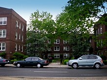
In 1941, Barney Spiegel bought a part of the Klein Farm at 69th Road and Main Street. On the land, he built 150 duplexes, designed by architect A. Salkowitz.
On July 14, 1965, the neighborhood became infamous when five-year-old Eddie Crimmins Jr. and four-year-old Missy Crimmins vanished from their garden apartment at 150-22 72nd Drive. Missy's body was found the same day in a vacant lot on 71st Avenue at 162nd Street (the area where the 107th Precinct is located today.) Eddie's body was found five days later near 68th Drive and the entrance to the northbound Van Wyck Expressway. The children's mother, Alice Crimmins, was convicted in 1971, and imprisoned, in the death of her children. She was paroled in 1977.
On September 16, 2010, an EF1 tornado touched down in Flushing Meadows–Corona Park, causing widespread damage to cars and homes in the Kew Gardens Hills area. John Bowne High School—located along Main Street at the edge of the CUNY Queens College campus, directly across from Mt. Hebron Cemetery—was the only New York City public school building to sustain physical damage related to the storm and was closed on the day after the storm.
Demographics
Based on data from the 2010 United States Census, the population of Kew Gardens Hills was 37,479, an increase of 1,427 (4.0%) from the 36,052 counted in 2000. Covering an area of 873.05 acres (353.31 ha), the neighborhood had a population density of 42.9 inhabitants per acre (27,500/sq mi; 10,600/km). The racial makeup of the neighborhood was 53.9% (20,184) White, 7.6% (2,839) African American, 0.2% (63) Native American, 20.0% (7,500) Asian, 0.1% (20) Pacific Islander, 0.4% (156) from other races, and 3.1% (1,169) from two or more races. Hispanic or Latino of any race were 14.8% (5,548) of the population.
The entirety of Community Board 8, which comprises Kew Gardens Hills as well as Fresh Meadows and Jamaica Hills, had 156,217 inhabitants as of NYC Health's 2018 Community Health Profile, with an average life expectancy of 83.9 years. This is higher than the median life expectancy of 81.2 for all New York City neighborhoods. Most inhabitants are middle-aged adults and youth: 20% are between the ages of 0–17, 28% between 25–44, and 27% between 45–64. The ratio of college-aged and elderly residents was lower, at 10% and 15% respectively.
As of 2017, the median household income in Community Board 8 was $64,005. In 2018, an estimated 22% of Kew Gardens Hills residents lived in poverty, compared to 19% in all of Queens and 20% in all of New York City. One in eleven residents (9%) were unemployed, compared to 8% in Queens and 9% in New York City. Rent burden, or the percentage of residents who have difficulty paying their rent, is 54% in Kew Gardens Hills, slightly higher than the boroughwide and citywide rates of 53% and 51% respectively. Based on this calculation, as of 2018, Kew Gardens Hills is considered to be high-income relative to the rest of the city and not gentrifying. The neighborhood has been described as "a largely middle-class area".
The neighborhood contains an established Orthodox Jewish population and some Israelis and Bukharan Jews, as well as smaller groups of Latinos, Koreans, Chinese, Indians, Afghans and African Americans. Kew Gardens Hills is home to the largest concentration of Afghanis in the New York metropolitan area.
There are several dozen houses of worship in Kew Gardens Hills, many of them Jewish.
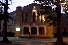
Established in 1941, the Jewish Center of Kew Gardens Hills is the only traditional Conservative synagogue located in the heart of Kew Gardens Hills. By the 1950s, the Orthodox Jewish community began to take root.
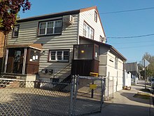
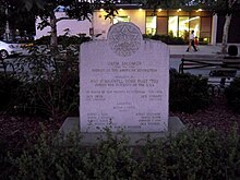
The first orthodox Jewish synagogue was formed in 1950 on Parsons Boulevard and 78th Road when the Jewish Center of Torath Emeth was formed with Rabbi Joel Laks as the spiritual leader. The following year, the Young Israel Congregation of Kew Gardens Hills was founded in 1951 with 15 families. That congregation now consists of 450 families. Congregation Machzikei Hadas formed by Rabbi Yosef Gelernter on 73rd Avenue, is home to the first mikveh in Kew Gardens Hills. In March 1960, the City Council named a small park at Vleigh Place and Main Street as Freedom Square to commemorate the one hundredth anniversary of the birth of Theodor Herzl, founder of present-day Zionism. The Yeshivas Chafetz Chaim, Ohr Hachaim and Kesser Torah are situated in Kew Gardens Hills. Jewish elementary schools include Yeshiva Ketana of Queens and Yeshiva of Central Queens.
Other houses of worship include the Roman Catholic Church Queen of Peace, located on Main Street at 77th Road. St. Nicholas of Tolentine is located on Parsons Boulevard behind east of Parkway Village. The Lutheran Church of the Ascension is located on Main Street just south of Union Turnpike. The Lutheran Church of the Redeemer, located on 65th Avenue near Parsons Boulevard, is also the facility used by the Korean Grace Community Church.
A sizable Muslim and Sikh population exists, most notably on the northern side with several stores catering to that population.
Education
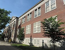
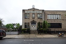
Kew Gardens Hills generally has a higher ratio of college-educated residents than the rest of the city as of 2018. Half of residents (50%) have a college education or higher, while 14% have less than a high school education and 37% are high school graduates or have some college education. By contrast, 39% of Queens residents and 43% of city residents have a college education or higher. The percentage of Kew Gardens Hills students excelling in math rose from 51 percent in 2000 to 71 percent in 2011, and reading achievement rose from 56% to 57% during the same time period.
Kew Gardens Hills' rate of elementary school student absenteeism is less than the rest of New York City. In Kew Gardens Hills, 15% of elementary school students missed twenty or more days per school year, less than the citywide average of 20%. Additionally, 86% of high school students in Kew Gardens Hills graduate on time, more than the citywide average of 75%.
Public schools
Kew Gardens Hills' public schools are operated by the New York City Department of Education. The following elementary and middle schools are located in Kew Gardens Hills, serving grades PK-5 unless otherwise indicated:
- PS 154
- PS 219 Paul Klapper
- PS 201 The Discovery School for Inquiry and Research
- PS 255 (grades PK-5, 8)
The following elementary-middle schools are located in Kew Gardens Hills and serve grades PK-8:
- PS 164 Queens Valley
- PS 165 Edith K. Bergtraum
- The Queens College School for Math, Science and Technology
- PS/MS 200 – The Pomonok School & STAR Academy
The following middle schools are located within Kew Gardens Hills:
- I.S. 250 The Robert F. Kennedy Community Middle School (grades 6-8)
- The Queens School of Inquiry (grades 6-12)
High schools in New York City are not zoned. The following high schools are located within Kew Gardens Hills and serve grades 9-12:
- John Bowne High School
- Robert F. Kennedy Community High School
- Townsend Harris High School serves academically gifted students.
- North Queens Community High School, founded in 2007 in the former Queens of Peace school building, which serves troubled New York City youths who wish to obtain their high school diploma.
Colleges and universities

Two university campuses are located in Kew Gardens Hills. Located in the northern portion of Kew Gardens Hills is Queens College, a liberal arts college that is part of the City University of New York (CUNY) system. Queens College also serves as an important cultural institution for neighborhood residents with Colden Center for the Performing Arts and the Godwin-Ternbach Museum.
Notable graduates of Queens College include native son Jerry Seinfeld, who was awarded an honorary doctorate in 1994, Ron Jeremy, and Paul Simon.
Lander College, the men's college of Touro College, has a large campus on 150th Street at 75th Road.
Private schools
Yeshiva Chofetz Chaim (76th Road & 147th Street), Lander College for Men (75th Road and 150th Street, a division of Touro College), and Yeshivas Ohr HaChaim (71st Avenue & Main Street, a division of Touro College) are large yeshivas located in Kew Gardens Hills.
Other religious schools located in Kew Gardens Hills include St. Nicholas of Tolentine, Shevach High School (Main Street at 75th Road), Mesivta Yesodei Yeshurun, Yeshiva of Central Queens (70th Road at 150th Street), Yeshiva Ketana (Parsons Boulevard & 78th Road) and Solomon Schechter School of Queens (76-26 Parsons Blvd.)


