Khumbu Pasanglhamu
Previously, Khumjung, Namche, Jubing and Chaurikharka were all separate local level body (Village development committee) of Solukhumbu District. Solukhumbu was a district out of six districts of Sagarmatha Zone. Sagarmatha was a zone (division) of Eastern development region of Nepal.
Etymology
Khumbu Pasanglhamu is located in Solukhumbu District, which name also bear Khumbu. "Solukhumbu" is a combination of two words; "Solu" and "Khumbu". Solu is lower part, while Khumbu is upper part of Solukhumbu District. The "Pasanglhamu" word is taken from Pasang Lhamu Sherpa, who was first Nepalese woman who climbed Mount Everest, she hailed from Khumbu region.
Geography and Climate
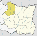
Khumbu Pasanglhamu is situated at coordinates 27.74° N 86.73° E Latitude and longitude. It is on northernmost part of Province, which is highest altitude land on Earth, part of higher Himalayas. Geographical condition of Khumbu Pasanglhamu is very difficult. It is the highest elevated land of the world. The minimum elevation of the region is 1,900 metres (6,200 ft), whereas the maximum elevation is 8,848 metres (29,029 ft). The total area of the rural municipality is 1,539.11 square kilometres (594.25 sq mi), thus it is the second largest Gaunpalika (by area) of Province No. 1 after Phaktanglung which is situated in Taplejung District.
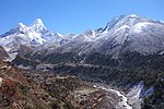
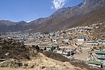
Lhotse, Nuptse, Cho Oyu, Ama Dablam, Pumori, Thamserku etc. are the mountains located in this region. Kharikhola, Lukla, Phskding, Manju, Namche, Khumjung, Khunde, Tengboche, Forche, Pangboche, Phiriche etc. are the human settlement in the region.
The elevations of Khumbu Pasanglhamu is not equal, it starts from 2000m and ends at 8848m thus the climate in the region can be divided into four climate zones owing to the gradual rise in altitude. The climatic zones include a forested lower zone, a zone of alpine scrub, the upper alpine zone which includes upper limit of vegetation growth, and the Arctic zone thus the temperature and weather conditions vary at different altitudes or zones. The upper zones are snow-capped mountains which is too cold and the lower zone's valleys are some less cold.
| Month | Jan | Feb | Mar | Apr | May | Jun | Jul | Aug | Sep | Oct | Nov | Dec | Year |
|---|---|---|---|---|---|---|---|---|---|---|---|---|---|
| Mean daily maximum °C (°F) | 9.3 (48.7) |
10.5 (50.9) |
13.5 (56.3) |
17.3 (63.1) |
18.4 (65.1) |
19.1 (66.4) |
19.1 (66.4) |
19.4 (66.9) |
18.1 (64.6) |
16.9 (62.4) |
13.3 (55.9) |
10.7 (51.3) |
15.5 (59.8) |
| Daily mean °C (°F) | 3.7 (38.7) |
5.1 (41.2) |
8 (46) |
11.5 (52.7) |
13.1 (55.6) |
15 (59) |
15.4 (59.7) |
15.4 (59.7) |
14.1 (57.4) |
11.8 (53.2) |
7.6 (45.7) |
4.9 (40.8) |
10.5 (50.8) |
| Mean daily minimum °C (°F) | −1.9 (28.6) |
−0.2 (31.6) |
2.6 (36.7) |
5.8 (42.4) |
7.9 (46.2) |
10.9 (51.6) |
11.8 (53.2) |
11.4 (52.5) |
10.2 (50.4) |
6.7 (44.1) |
1.9 (35.4) |
−0.8 (30.6) |
5.5 (41.9) |
| Average precipitation mm (inches) | 16 (0.6) |
30 (1.2) |
34 (1.3) |
60 (2.4) |
107 (4.2) |
301 (11.9) |
555 (21.9) |
479 (18.9) |
288 (11.3) |
90 (3.5) |
12 (0.5) |
10 (0.4) |
1,982 (78.1) |
| Source: Climate-data.org | |||||||||||||
References
- ^ "List of Local bodies of Nepal". MoFALD. Retrieved 2 June 2017.
- ^ "Khumbu Pasanglahmu Rural municipality in Nepal". www.citypopulation.de. 8 October 2017. Retrieved 12 March 2018.
- ^ "744 new local units come into effect". The Kathmandu Post. Retrieved 15 March 2017.
- ^ "खुम्बु पासाङल्हामु गाउँपालिकाको संक्षिप्त परिचय". www.khumbupasanglhamumun.gov.np. 5 May 2018.
- ^ "Everest Travel guide – Solu Khumbu trekking guide". www.explorehimalaya.com. Retrieved 26 June 2018.
- ^ "Climate:Chaurikharka". Retrieved 25 June 2018.


