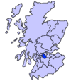
Luggiebank

The village consists of around 30 houses and is essentially built around two streets: the older part of Stirling Road and newer houses on Blairlinn View, named after the farmsteads of Wester, Mid and Easter Blairlinn. Other farms and houses in the surrounding area are deemed to be in Luggiebank. On the south bound side of Stirling Road the houses back onto Luggie Water. The associated glen is now a nature reserve managed by the Scottish Wildlife Trust. The name comes from a cottage of that name which appears on the first Edition of the Ordnance Survey.
In a Scots dictionary, luggie can mean a wooden bucket with handles. An extract from the Ordnance Gazetteer of Scotland 1882 describes The Luggie in less than glowing terms. Two poems by Victorian poet David Gray fondly reminisce upon The Luggie: 'The Dear Old Toiling One' and 'The Luggie'.
The historical village houses are displayed on the north bound side of Stirling Road in the 1864 Ordnance Survey map. People used to go on holiday in the village and there is a postcard looking south, showing the village possibly from the 1930s. The Luggie Bridge, just to the north of the village, is a stone arch that now forms part of the foot way north out of the village.
References
- ^ Taylor, Jessica (2010). Cumbernauld: The Conception, Development and Realisation of a Post-war British New Town (PDF). Edinburgh: Edinburgh College of Art. p. 179. Retrieved 25 February 2017.
- ^ "Luggiebank Wood". Scottish Wildlife Trust. Retrieved 6 August 2016.
- ^ "OS 6 inch Map 1892-1960". zoomable map with Bing transparency overlay. National Library of Scotland. Retrieved 10 October 2017.
- ^ "luggie". Dictionary of the Scots Language. Retrieved 21 October 2017.
- ^ "Ordnance Gazetteer of Scotland: Luggie Water". Electric Scotland. Retrieved 21 October 2017.
- ^ Stedman, Edmund Clarence (1895). A Victorian Anthology 1837-1895. Boston and New York: Houghton Mifflin Company. pp. 271–272. Retrieved 21 October 2017.
- ^ Bell, Henry Glassford (1874). The Poetical Works of David Gray. J. Maclehose. Retrieved 11 August 2016.
- ^ "OS 25 inch map 1892-1949, with Bing opacity slider". National Library of Scotland. Ordnance Survey. Retrieved 12 October 2017.
