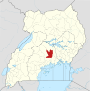
Luweero–Butalangu Road
Location
The road starts at Luweero (pop. 42,734), and continues through Kiwoko (pop. 11,013), to end at Butalangu (pop. 3,873), a total distance of approximately 29 kilometres (18 mi). The geographical coordinates of this road immediately west of downtown Kiwoko are:0°51'19.0"N, 32°20'27.0"E (Latitude:0.855278; Longitude:32.340833).
Upgrading to bitumen
In December 2016, the Uganda National Roads Authority (UNRA) announced its intention to upgrade the gravel surfaced road to class II bitumen surface. The improvements are budgeted at US$40 million co-financed by the Arab Bank for Economic Development in Africa (BADEA) and the OPEC Fund for International Development (OFID), and are expected to last two years. UNRA sought parliamentary approval to borrow the required funds and received approval in December 2016.
In February 2017, BADEA and the government of Uganda signed loan agreements at BADEA's headquarters in Khartoum, for the funding portion of the road upgrade that BADEA has agreed to finance. Sidi Ould TAH, the Director General of BADEA signed on behalf of BADEA and Matia Kasaija, Minister of Finance, Planning and Economic Development signed for Uganda.
In UNRA's end-of-year report for 2016/2017, which ended on 30 June 2017, this road is listed among those road projects at the "Feasibility study for road upgrading" stage.
Developments
The engineering, procurement and construction (EPC) contract was awarded to Dott Services Limited. Construction was launched on 9 June 2023, with commissioning expected after 36 months. The contract price is reported as USh93 billion (approx. US$25.2 million). As of September 2024, 10 percent of the work had been concluded.
See also
References
- ^ Kiwanuka, Frederick (3 October 2016). "UNRA to upgrade Luwero–Nakaseke road". New Vision. Kampala. Retrieved 1 August 2017.
- ^ UBOS (27 August 2014). "The Population of The Regions of the Republic of Uganda And All Cities And Towns of More Than 15,000 Inhabitants". Citypopulation.de Quoting Uganda Bureau of Statistics (UBOS). Retrieved 1 August 2017.
- ^ UBOS (November 2014). "National Population and Housing Census 2014: Provisional Results: Appendix 3 - Households and Population by Subcounty/ Town Council/Urban Division and Sex, 2014" (PDF). Kampala: Uganda Bureau of Statistics (UBOS). Archived from the original (PDF) on 10 January 2017. Retrieved 1 August 2017.
- ^ Kiwanuka, Frederick (3 October 2016). "UNRA to upgrade Luwero–Nakaseke road". New Vision. Kampala. Retrieved 1 August 2017.
- ^ "Location of Luweero–Butalangu Road West of Kiwoko Town" (Map). Google Maps. Retrieved 1 August 2017.
- ^ DFM (22 December 2016). "Parliament Approves a Loan to Support the Multinational Roads Construction". Kampala, Uganda: 106.5 Digida FM (DFM). Retrieved 1 August 2017.
- ^ Frederick Kiwanuka (19 April 2017). "US$40 Million Loan Secured For Luweero–Nakaseke Road Project". New Vision. Kampala, Uganda. Retrieved 3 April 2019.
- ^ "BADEA & Uganda sign a loan agreement and a guarantee agreement". Financialafrik.com. 19 February 2017. Retrieved 1 August 2017.
- ^ Allen Kagina (25 July 2017). "UNRA end of Financial Year 2016/2017 Statement". Uganda Media Centre. Kampala, Uganda. Retrieved 1 August 2017.
- ^ Conslata Taaka (13 September 2024). "Frustration grows over delayed Luweero-Butalangu road project". Nile Post Uganda. Kampala, Uganda. Retrieved 15 September 2024.

