Mooresburg, Tennessee
Demographics
This section is empty. You can help by adding to it. (September 2024) |
| Census | Pop. | Note | %± |
|---|---|---|---|
| 2020 | 877 | — | |
| U.S. Decennial Census | |||
History
Mooresburg was named for Major Hugh Moore, whose family settled in the area around 1800. Hugh had purchased over several thousands and laid out the setting for the town of Mooresburg.
Mooresburg has a post office with ZIP code 37811, which opened on March 4, 1814.
Following the impoundment of the Holston River by the Tennessee Valley Authority in the 1941, many property owners were relocated to make way for Cherokee Lake. In the 1970s, the community was impacted by the construction of U.S. Route 11W into a four-lane limited-access highway.
In 1977, 100 acres of Mooresburg was proposed to be inside the city limits of Bean Station during an incorporation vote. However voters in both Grainger and Hawkins counties rejected to incorporate.
From its first unveiling in the 1940s, over 1,900-2,200 acres of undisturbed forest north of the community was proposed and planned as state park known as Poor Valley State Park in order to promote economic development efforts in the upper East Tennessee region, the plan would stall in the 1970s.
Education
Mooresburg Elementary School serves grades K-5. Mooresburg Elementary School's mascot is the Mustangs. The motto is "Excellence: Not Optional." The school colors are blue and white.
Infrastructure
Mooresburg is served by the Lakeview Volunteer Fire Department.
Notable People
- Scott Bloomquist - Dirt Racing Champion and Nascar Driver
References
- ^ "Historic Mooresburg". Mooresburg Community Association. Archived from the original on March 4, 2016. Retrieved February 14, 2021.
- ^ "ArcGIS REST Services Directory". United States Census Bureau. Retrieved October 15, 2022.
- ^ "Census Population API". United States Census Bureau. Retrieved October 15, 2022.
- ^ "Mooresburg". Geographic Names Information System. United States Geological Survey, United States Department of the Interior.
- ^ "U.S. Census website". United States Census Bureau. Retrieved May 14, 2011.
- ^ "Census of Population and Housing". Census.gov. Retrieved June 4, 2016.
- ^ United States Postal Service (2012). "USPS - Look Up a ZIP Code". Retrieved February 15, 2012.
- ^ "Postmaster Finder - Post Offices by ZIP Code". United States Postal Service. Retrieved November 24, 2012.
- ^ "Bean Station Plan Fails". Kingsport Times-News. September 19, 1977. p. 8. Retrieved October 19, 2020 – via Newspapers.com.
- ^ Hodge, Tom (March 31, 1957). "Poor Valley State Park Proposed For ET Area". Johnson City Press. Retrieved May 12, 2021.
- ^ Johnston, Sheila (October 27, 1976). "Poor Valley Park: The Wait Goes On". Kingsport Times-News. Retrieved May 12, 2021.
External links
Municipalities and communities of Hawkins County, Tennessee, United States | ||
|---|---|---|
| Cities | 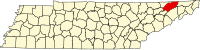 | |
| Towns | ||
| CDP | ||
| Unincorporated communities | ||
| Ghost town | ||
| Footnotes | ‡This populated place also has portions in an adjacent county or counties | |
This Hawkins County, Tennessee geography–related article is a stub. You can help Wikipedia by expanding it. |