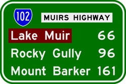
Muir Highway, also called Muirs Highway, is a Western Australian highway linking Manjimup and Mount Barker, which is on the Albany Highway. It is signed as State Route 102 and is 161 kilometres (100 mi) long. It provides a shorter distance between Manjimup and Albany. It is a lonely highway surrounded with karri and jarrah forests with no settlements in between except the small farming settlement of Rocky Gully.
It is primarily used as a freight route for plantation timber trucks and interstate long vehicles servicing the horticultural areas of the South West. The road is a two way, single carriageway bitumen surfaced highway.
Muir Highway passes through several localities including Manjimup, Dingup, Nyamup, Strachan, Murtinup, Rocky Gully and Mount Barker.
Muir Highway was named after brothers Thomas and John Muir, the first European settlers in the Warren district, who settled at Deeside in 1852 and built a rush hut there in 1856.
^South West Region map(PDF) (PDF). Version 1.0. Cartography by Main Roads Western Australia. Main Roads Western Australia. 13 August 2013. Archived from the original(PDF) on 28 September 2013. Retrieved 28 December 2012.