Perchas 2
History
Perchas 2 was in Spain's gazetteers until Puerto Rico was ceded by Spain in the aftermath of the Spanish–American War under the terms of the Treaty of Paris of 1898 and became an unincorporated territory of the United States. In 1899, the United States Department of War conducted a census of Puerto Rico finding that the combined population of Perchas 1 and Perchas 2 barrios was 1,429.
| Census | Pop. | Note | %± |
|---|---|---|---|
| 1910 | 972 | — | |
| 1920 | 1,066 | 9.7% | |
| 1930 | 1,082 | 1.5% | |
| 1940 | 971 | −10.3% | |
| 1950 | 1,049 | 8.0% | |
| 1960 | 1,118 | 6.6% | |
| 1970 | 682 | −39.0% | |
| 1980 | 814 | 19.4% | |
| 1990 | 945 | 16.1% | |
| 2000 | 1,072 | 13.4% | |
| 2010 | 988 | −7.8% | |
| U.S. Decennial Census 1900 (N/A) 1910-1930 1930-1950 1980-2000 2010 | |||
Sectors
Barrios (which are roughly comparable to minor civil divisions) in turn are further subdivided into smaller local populated place areas/units called sectores (sectors in English). The types of sectores may vary, from normally sector to urbanización to reparto to barriada to residencial, among others.
The following sectors are in Perchas 2 barrio:
Carretera 124, Carretera 435, Comunidad Alturas de Borinquén, Parcelas García Méndez, Sector Ángel Ríos, Sector Entrada Oronoz, Sector Finca Los Abuelos, Sector Genaro Vélez, Sector Lito Rodríguez, Sector Olavarría, Sector Pablo Fernández, Sector Pelo Muerto, Sector Perfecto Rodríguez, Sector Parcelas González, Sector Pulio Rodríguez, Sector Santo Domingo, and Sector Tosquera.
Gallery
Scenes in Perchas 2:
-
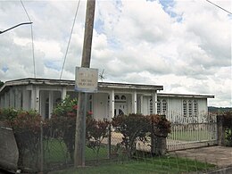 Home in Sector Olavarría
 -
 Stream in Sector Santo Domingo
 -
 Sector Santo Domingo
 -
 Bamboo in Sector Santo Domingo
 -
 Sector Santo Domingo
 -
 Breadfruit tree in Sector Santo Domingo
 -
 Sector Santo Domingo


