Perinthalmanna Taluk
Geography

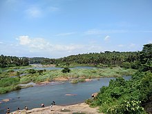
Perinthalmanna Taluk is bounded by Kadalundi River (Eranad Taluk) to north, Thuthapuzha River (a tributary of Bharathappuzha) to south, Kuttippuram block of Tirur Taluk to west, and Mannarkkad Taluk (Silent Valley) to east.
History

Perinthalmanna was the headquarters of the Old Walluvanad Taluk in the British Malabar District. Walluvanad Taluk was divided into six Revenue blocks: Mankada, Perinthalmanna, Mannarkkad, Ottapalam, Sreekrishnapuram, and Pattambi. Walluvanad was one of the two Taluks included in the Malappuram Revenue Division (the other being Eranad Taluk) of British Malabar. On 1 November 1957, the Walluvanad Taluk was divided into two: Perinthalmanna Taluk and Ottapalam Taluk. The Revenue blocks of Mankada, Perinthalmanna, and Mannarkkad were included in the Perinthalmanna Taluk, while Ottapalam, Sreekrishnapuram, and Pattambi were transferred to the newly formed Ottapalam Taluk. Later Attappadi Revenue block was separated from Mannarkkad Block.
During the formation of Malappuram district on 16 June 1969, it was separated from Palakkad district and Revenue blocks of Mannarkkad and Attappadi were separated from Perinthalmanna Taluk to form Mannarkkad Taluk. Now, Perinthalmanna Taluk has 24 villages.
Villages
The taluk contains 24 revenue villages:
- Aliparamba
- Anamangad
- Angadippuram
- Arakkuparamba
- Edappatta
- Elamkulam
- Kariavattom
- Keezhattur
- Kodur
- Koottilangadi
- Kuruva
- Kuruvambalam
- Mankada
- Melattur
- Moorkkanad
- Nenmini
- Pathaikara
- Perinthalmanna Town
- Pulamantol
- Puzhakkattiri
- Thazhekode
- Vadakkangara
- Valambur
- Vettathur
Municipality and panchayats
The taluk contains 1 municipality and 15 panchayats:
- Perinthalmanna Municipality
- Alipparamba Panchayath
- Angadippuram Panchayath
- Edappatta Panchayath
- Elamkulam Panchayath
- Keezhattur Panchayath
- Kodur Panchayath
- Koottilangadi Panchayath
- Kuruva Panchayath
- Mankada Panchayath
- Melattur Panchayath
- Moorkkanad Panchayath
- Pulamanthole Panchayath
- Puzhakkattiri Panchayath
- Tazhekkode Panchayath
- Vettathur Panchayath
Taluks of Malappuram
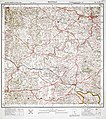
Historical maps
-
Malabar District in 1854
-
Valluvanad Taluk in 1909
-
An area of Valluvanad Taluk in 1912
-
Malabar District in 1951
See also
- List of villages in Malappuram district
- List of Gram Panchayats in Malappuram district
- List of desoms in Malappuram district (1981)
- Revenue Divisions of Kerala
References
- ^ "Villages, Taluks, and Revenues divisions that make up Malappuram district". Official website of Malappuram district.
- ^ "Villages | Welcome to Malappuram | India". Retrieved 21 December 2023.
- ^ K. Narayanan (1972). District Census Handbook - Malappuram (Part-C) - 1971 (PDF). Thiruvananthapuram: Directorate of Census Operations, Kerala. p. 3.
- ^ Directorate of Census Operations, Kerala. District Census Handbook, Malappuram (PDF). Thiruvananthapuram: Directorate of Census Operations, Kerala.
- ^ 1951 census handbook - Malabar district (PDF). Chennai: Government of Madras. 1953. p. 1.
- ^ Devassy, M. K. (1965). District Census Handbook (3) - Palakkad (1961) (PDF). Shoranur: Government of Kerala.
- ^ "History | Palakkad | India". Retrieved 30 August 2022.


