Pheca
39°31′25″N 21°37′47″E / 39.52371°N 21.629739°E
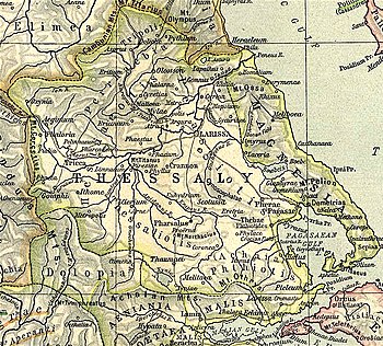
Map showing ancient Thessaly. Phaeca is shown to the centre left near Gomphi.

Pheca or Phaika or Phaeca (Ancient Greek: Φαίκα) or Phecadum was a fortress and town lying between the pass of Portes and Gomphi in ancient Thessaly. In the war against Philip V of Macedon, Amynander of Athamania, king of the Athamanes, in co-operation with the Roman consul Titus Quinctius Flamininus, having descended from the pass of Portes, first took Pheca and then Gomphi itself, 198 BCE.
The site of Pheca is at modern Varybobi.
References
- ^ Livy. Ab urbe condita Libri [History of Rome]. Vol. 31.41, 32.14.
- ^ Livy. Ab urbe condita Libri [History of Rome]. Vol. 32.14.
- ^ Richard Talbert, ed. (2000). Barrington Atlas of the Greek and Roman World. Princeton University Press. p. 55, and directory notes accompanying. ISBN 978-0-691-03169-9.
- ^ Lund University. Digital Atlas of the Roman Empire.
| Authority control databases: Geographic |
|---|
This article about a location in ancient Thessaly is a stub. You can help Wikipedia by expanding it. |