Rafferty Dam
The reservoir provides water to the Shand Power Station and to the city of Estevan. A 10-kilometre long pipeline supplies the power station and a 9.2-kilometre long pipeline, which originates along the Souris River river bed at the bottom of the reservoir, brings water to the Estevan water treatment plant. The water pipeline that brings water to Estevan was completed in 2020 after a three-year project that changed the source of Estevan's drinking water away from Boundary Dam Reservoir.
Rafferty Dam

Rafferty Dam (49°09′08″N 103°05′22″W / 49.1522°N 103.0894°W) is at the south-eastern corner of the lake, about 4.8 kilometres (3.0 mi) upstream from Estevan. It was built in conjunction with the Grant Devine Dam (formally known as Alameda Dam), which was built further downstream on Moose Mountain Creek. Both dams are operated by the Saskatchewan Water Security Agency. The dam and reservoir provide flood control along the Souris River, irrigation, and recreation.
The height of the top of the dam is 555 m (1,821 ft) above sea level. The maximum height available for flood control is 554 m (1,818 ft). The normal full supply level is 550.5 m (1,806 ft) and the normal drawdown level is 549.5 m (1,803 ft). The maximum draw down is 547.5 m (1,796 ft) above sea level. At full supply, the reservoir covers an area of 4,881 ha (12,060 acres). Two additional dams were built to contain the reservoir: The 12.1-metre (40 ft) high Rafferty R3-2 Closure Dam (49°20′36″N 103°32′06″W / 49.3434°N 103.5351°W) and the 10.3-metre (34 ft) high Rafferty R4-1 Closure Dam (49°22′18″N 103°34′50″W / 49.3717°N 103.5805°W). Highway 606 crosses R3-2 and R4-1 is at Mainprize Regional Park.
A 10-kilometre (6.2 mi) long spillway connects the Boundary Dam Reservoir to McDonald Lake, allowing excess water to flow into McDonald Lake. The flow can also be reversed if necessary.
Mainprize Regional Park
Mainprize Regional Park (49°22′09″N 103°34′56″W / 49.3691°N 103.5821°W) is a regional park in the RM of Cymri No. 36 on the eastern shore at the northern end of McDonald Lake. The park includes a golf course, a campground, cabins, Pederson Place (a 5,000 sq ft (460 m) multi-purpose hall with a 3,000 sq ft (280 m) deck), a beach area, group camping, a boat launch, hiking trails, and four residential cottage subdivisions. Access to Mainprize is from Highway 606.
In 1961, the regional park was founded in the Souris River Valley about 5 kilometres (3.1 mi) downstream from the park's current location. With the building of the Rafferty Dam and subsequent flooding of the valley, the park was moved to its current location. It was named after Dr. William Graham Mainprize, who served the nearby community of Midale for over 50 years.
The golf course is a par 72, Scottish links-style 18-hole course that was built in 1994. It has grass greens and there are 6,958 total yards. Amenities include a pro shop, rentals, a restaurant, and a licensed lounge.
Fish species
Fish commonly found in McDonald Lake include walleye, northern pike, white sucker, and yellow perch. Between 1992 and 1999, the lake was stocked with over 20 million walleye.
Gallery
-
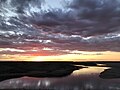 Sunset on McDonald Lake
 -
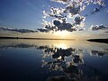 McDonald Lake
 -
 McDonald Lake
 -
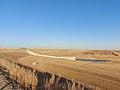 The dam's spillway
 -
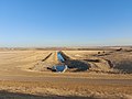 The dam's riparin outlet
 -
 The information sign at the look out at Rafferty Dam

.jpg)
.jpg)


See also
- Lake Darling Dam
- 2011 Souris River flood
- Boundary Dam Power Station
- List of dams and reservoirs in Canada
- List of lakes of Saskatchewan
- Tourism in Saskatchewan
References
- ^ "McDonald Lake". Angler's Atlas. Retrieved 21 March 2024.
- ^ "McDonald Lake". Mapcarta.
- ^ "McDonald Lake". Canadian Geographical Names Database. Government of Canada. Retrieved 1 May 2023.
- ^ Florizone, Alaura (16 July 2020). "Ceremony for the New Waterline at Rafferty Dam". Discover Estevan. Retrieved 21 March 2024.
- ^ "Rafferty-Grant Devine Project". Water Security Agency. 22 February 2021. Retrieved 21 March 2024.
- ^ Park, Norm (10 August 2011). "Detailed review of dams and reservoirs coming". Sask Today. Glacier Media Group. The Mercury. Retrieved 21 March 2024.
- ^ "Dams and Reservoirs". wsask. Water Security Agency. 27 January 2021. Retrieved 20 March 2024.
- ^ "Mainprize Regional Park and Golf Club". Tourism Saskatchewan. Government of Saskatchewan. Retrieved 21 March 2024.
- ^ "Mainprize". Regional Parks of Saskatchewan. Saskatchewan Regional Parks. Retrieved 21 March 2024.
- ^ "Mainprize Regional Park and Golf Course". Golf Pass. Retrieved 21 March 2024.
- ^ "Rafferty Reservoir". Sask Lakes. Retrieved 21 March 2024.
- ^ "McDonald Lake". Fishbrain. Retrieved 21 March 2024.
External links
 Media related to McDonald Lake (Saskatchewan) at Wikimedia Commons
- Mainprize Regional Park